RubiKon Adventures

Tales and travels of "GrizzLee", "Looksha Lori" & "Yukon Johann"


Monday, August 31, 2015

Solo Beyond The Northern Hinterlands: Germans, A Man Turns 50, The Denali Hwy and Gretchen Gets a New Shoe


Email acct (complete with spelling and grammatical errors)

////////////////////////////////
Solo Beyond The Northern Hinterlands: Germans, A Man Turns 50, The Denali Hwy and Gretchen Gets a New Shoe
Germans, A Man Turns 50, The Denali Hwy and Gretchen Gets a New Shoe
From: Grizz Lee <grizzlee@xxxxxx.net>
Date: Tue, Jul 14, 2015 at 11:32 PM
Subject: Germans, A Man Turns 50, The Denali Hwy and Gretchen Gets a New Shoe

As I left Dawson City, the weather began to deteriorate. I knew from the weather reports that I was to experience scattered showers. However, about 10 miles above Dawson on the “Top of the World Hwy”, the sky opened up. It was déjà vu all over again. In 2013 Yukon Johann and I had a similar experience. The difference this time was that the roads weren’t all tore up. On the US side, they had actually paved 12 miles of road. The same 12 miles of shitty hell that was torn to pieces in 2013. I arrived in Chicken, wet and cold. There was a bright side, however, out front sat 2 KTM 950s and inside there was FREE COFFEE!! The coffee, was great. Not because it tasted good, which it didn’t, but because it raised my core temperature to a tolerable level. Once the shivers stopped, I began chatting with the owners of the KTMs. Their names were Claus and Jo. Two pals that were circumnavigating the globe on motorcycles. They were doing it 4 weeks at a time each year. Last year they finished the Road of Bones in Russia to Magadan and travelled Mongolia. They had some stories to tell. I had to hear them. We agreed to meet up in Tok, Ak and possibly travel towards Fairbanks together. Great time. We drank beer exchanged adventures. In the end, when we parted ways at Delta Jct the next day. We agreed to meet up next year as they ride through the west coast on their way to Mexico. Maybe, even possibly ride together a bit.

Claus and Jo, travelling the world on KTM 990 Adventure Bikes

Attack by the state bird

Facts about the ALCAN

The End of the ALCAN Hwy in Delta Junction
Maybe it was a sign, or maybe it was fate, but as I headed south on the Richardson highway, alone, the sun disappeared and the dark sky was again my friend. The Richardson Hwy was beautiful, as I saw 2 black bears and got to photograph/video a lone moose grazing in a pond. Along the way I had a near miss with a moose crossing the road. A real pucker moment. I arrived at Summit Lake and the rains really began to worsen. I was near 4000 feet in a valley surrounded by glaciers ... although I couldn’t see them from all the clouds.
Lone Moose on the Richardson Hwy

Roadside stop that should've been scenic if it weren't for the weather
I pulled into Tangle Lakes Lodge for a bite. I also wanted to dry off a bit. The sun came out and it was gorgeous. So I decided to set up camp at a developed campsite nearby. No sooner had I gotten the tent up and it began to rain again. It was a wet, humid night and a bit chilly. The next morning it was cold, but breezy. So I dried everything out and hit the road. I was traveling the high country, riding parallel to the Alaska Range. There were supposedly 12,000 foot peaks and lots of glaciers. Occasionally I got a sneak peak of the glaciers, but the mountains stayed hidden in the clouds. Along the way, I met a gent riding a new BMW 1200 R. He rode up from Los Angeles. He had just turned 50 years old and this was his Birthday Present to himself. I told him that was exactly what I was doing as well.

May map says there are glaciers back there

The Denali Hwy - Cold and Beautiful

The road heads through that notch in the center across the tundra

I loved the views form this pass at Maclaren Summit

Coming down Maclaren Summit


After 136 miles, I was at the end of the gravel highway and found myself at Cantwell, the entrance to Denali Nat’l Park. Of course, the sun was shining and the temperature rose to 80 degrees. I had to peel my rain gear off and dry out again. I headed to Fairbanks through several construction zones. 2 hours to go 30 miles yikes!!! I arrived at Fairbanks where I had reservations for a room at the University of Alaska (Thanks to Lori who called ahead for me). Luckily, I had the reservations, because they were full. First time ever they said. They rent student door rooms for $38/night during the summer. Shared showers and bathrooms, but the laundry is free. Not a bad deal considering that motels run about $130-$150/night  in Fairbanks during the summer. In any event, I was glad I was indoors as it rained hard overnight. I decided to stay an extra day because I needed to get a new tire for the rear installed and secondly, I really needed a break from riding for a day.

Scenic ponds and lakes

Gretchen was having a great time.

Whoze dat guy?

The clouds were lifting

Towars the end of the Denali Hwy, the clouds receded and I
could see the base of the Alaska Range that eluded me all day :-(

Scenic rivers proved to the best views I had

An Adventure Rider Moment

It began to get warm and interesting as I finished the Denali Hwy

I spent a good chunk of my time off at Adventure Cycle Works just north of Fairbanks. It is a business run by Dan Armstrong who caters to the adventure riders passing through and/or doing the Dalton Highway to Prudhoe Bay. Dan is the salt of the earth type of guy. However, one thing you don’t want to mention is that you own a Harley. He doesn’t like Harleys and Hondas. He said he will not work on either. In fact, if you pull up on a Harley, he will politely ask you to leave and/or park it along the street, downwind from his home/business. He put a brand shoe on my Gretchen. Recall, earlier, 4 days into my trip, I had my first flat on the rear tire and thus had a plug in it. All working fine, but with the tires over 50% gone and still a long way to go home, I felt better about having a new shoe installed. Gretchen is loving her new Heidenau K60 rear tire and I am going to sleep better knowing that I have good tires … one less thing to worry about.

Well, it is time to turn in and start thinking about the ride home. Tomorrow, I point my bike south and begin the journey home. It is always a bit somber for me, as I hate leaving the north. It is a place I feel like I belong, my home. Soon I will be in the big city, fighting traffic, working and dreaming about my next trip north. However, there are still some adventures waiting for me on the way home…
////////////////////////////////////////


Until Next Time...

Friday, August 28, 2015

Solo Beyond The Northern Hinterlands 2015: Bears, the Dempster Highway and A Hard Decision

Bears, the Dempster Highway and A Hard Decision


Only 2 roads penetrate the arctic in North America, the Dempster Highway in Canada and the Dalton Highway in Alaska. Of the two roads, the Dempster Highway, is the most beautiful on a mile-by-mile basis. It stretches beyond the Klondike gold fields to the Mackenzie Delta. It snakes a path of over 450 miles long through the mountains and the arctic lowlands. Words and pictures alone cannot describe this part of the world. The sun shines not for a day, but for an entire season. Wildlife abounds, unfettered by the ever expanding domain of man and his propensity to plunder everything in sight. The road is like no other, and to call it a highway is somewhat misleading. It is a gravel ribbon spread over a vast wilderness frontier.

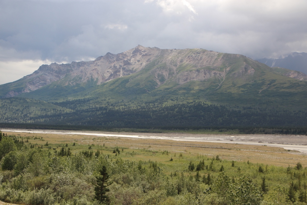
The start of the Dempster Highway
I left Carmacks on the Yukon River and headed over to Frenchman Lakes. Fortunately, the rain subsided and the following day was splendid. Frenchman Lakes is a chain of lakes that are north of the Klondike Hwy. They are beautiful and not widely publicized. As a result, I saw only 2 other groups out there. It was nice relaxing ride on good gravel roads.

I exited north of the infamous 5 Finger Rapids on the Yukon river and proceeded to head north.

I stopped at Minto to eat my lunch and enjoy the sunshine along with a nap. From there I proceeded northward toward Pelly crossing where I encountered another rider who recognized me from my YouTube Videos. He was traveling with his sister and his mom. They were in a van and he was on his bike... a brand new R1200 GSA, nice and light.

I decided that my trip wouldn't be complete without taking a trip up the Dempster Hwy and spending the night in Tombstone Park. It was a cold night in the park campground, but the net day ... HEAVEN!! I stopped in the visitors center to get a road and weather report. I had visions of possibly riding all the way north to Inuvik. While I have been here 3 times prior, I have never been on a motorcycle, let alone, solo.

Something was missing, so I got into the picture...
The prognosis was that the day was supposed to be warm and wonderful. However, the next few days didn't look so good. I met a couple of folks who had just returned from Eagle plains, the 1/2 way point up towards Inuvik and told me the road conditions just before Eagle Plains were a mess. It had rained heavily and there were deep ruts with lots and lots of mud. They stated that even in their Subaru with 4wd it was very slippery.
Looking into the heart of Tombstone Park
I decided that I would at least head up to the Black Stone uplands. On my way, I ran into a couple of riders coming back from Inuvik. They confirmed the road conditions and said it was tough going because of the mud. One of them did state that the warm day may actually make the road conditions more favorable. Hmmm... I still proceeded north ward. The weather was so nice that I proceeded beyond the Blackstone uplands and began having thoughts of skipping the Denali Hwy and doing the Dempster. The decision was getting harder mile by mile. A pair of KLR riders (husband and wife) passed by and I followed them for a spell. The weather north looked dark and gloomy, but where I was at, it was paradise, the road conditions were excellent.

I passed through the Blackstone uplands, traditional lands of the Takudh Gwich’in and Teetlit Gwich’in people. There is a memorial on the roadside dedicated to two of the most beloved natives int eh area, that being Joe and Annie Henry. Both lived beyond 100 years and had a trap line off the Dempster hwy near Wolf Creek. Most folks traveling this area are likely to miss their cabin and even the memorial at the place that was once known as Black City in the Blackstone uplands.

Views from the Dempster
From there I proceeded north through the Olgivie mountains after passing Two Moose Lake and Pilots Peak. A note about Pilots Peak, my son and I climbed this peak in the summer of 2007. Magnificent territorial views are had from the summit. A little known fact is that some of the coldest temperatures in Canada are observed here in this area. Even colder than the northern end of the highway.

I was about 20 miles into the Ogilvie mountains when I came across a blonde grizzly mom and her two cubs in the middle of the road.

From there I ambled amilessly, stopping for water and a power bar.... just really soaking up the views. I eventually turned around about 30 miles north of a place called Engineer Creek. My heart was torn. Even though I saw the rain clouds north, I really wanted to press on, but that would mean sacrificing another part of my trip. Since I had traveled up the Dempster Hwy 3 times before, I decide to turn back. I nearly used up all my fuel and I pulled into Dawson City on an empty tank.

Tired and hungry, I got a room at the famous Downtown Hotel. I showered and then ordered some Back Alley Pizza. I sat alongside the Yukon river and enjoyed my dinner in the warm peaceful glow of the northern sunshine.
There are several Thermokarsts (or thaw lake) within
the Ogilvie mountain range. Pools of melt-water that happen
on permafrost soils of the arctic

Email acct (complete with grammatical and spelling errors...)
//////////////////////////////////////////////////////////////////////
Bears, the Dempster and A Hard Decision
From: Grizz Lee <grizzlee@xxxxx.net>
Date: Fri, Jul 10, 2015 at 10:44 PM
Subject: Bears, the Dempster and A Hard Decision

I made my way up 150 miles up the Dempster highway today.  I was torn about continuing or turning around and continuing my planned route to travel to new places. I’ve traveled the Dempster hwy 3 times already. I’ve experienced it on a level that few ever get to experience. Yet, I find myself drawn to her. Without a doubt the most beautiful place in the Yukon. The best road to travel up here IMHO when the weather is good.

The weather was supposed to deteriorate as the day wore on. It was also supposed to dip to the freezing levels. Yes, it was a cold night during my stay in Tombstone Territorial Park. I also wish to ride the Dempster with another, to share in the experience and provide an element of safety comfort. Perhaps, more heavy on my mind was the intel I received from travelers heading south. They all said the road was full of ruts, muddy as heck, and slippery for several kilometers before Eagle Plains, the halfway point on the Dempster. One fellow BMW rider said it was very hairy. His bike and his body were covered head to toe with thick mud. Not just any mud, Calcium Chloride. A nasty binding agent for gravel that is very corrosive and sticks to anything like a magnet. He said that he got sprayed down at Eagle plains with a power washer before they would let him in the restaurant.
I made a compromise and decided to ride up past Engineer Creek, up to the first major road rehabilitation crew. A good move IMHO as the there were thick clouds up ahead. Along the way I had an experience that was magical. I came across a beautiful Blonde Grizzly mom and her cubs, also blonde. They were the most beautiful bears I have ever seen. They were in the road when I came upon them and I scared them as I came around the corner on my bike. Initially mom stood her ground in the road and growled at the cubs and they scattered up a rocky slope. Mom soon followed. I watched them and after a bit, mom found a grassy rest spot and began nursing the cubs. I watched a bit and then moved on. When I returned 2 hrs later, mom and cubs were asleep in the same spot. They blended in so well, that passers by would never notice them.

In any event, I arrived in Dawson and was able to secure the last room in the Downtown Hotel. Piano playing in the bar, adventure bikes parked out front..  I was able to order some Back Ally Pizza just before they shut down for the evening. Damn good pizza … the best I’ve ever eaten. No trip to Dawson is complete without it. I also ran into a familiar face … Jurgen, a retired East German man. A quirky old man and very comical to encounter on the river.  Lori and I met him in our 2012 paddle adventure trip down the Yukon River. His cotton shirt and blue jeans, combined with his bag of potatoes and rubber slicker were something to see in the cold rain on Lake Laberge.  He even got lost that year. He told me that he paddled the river again this year on a homemade raft. His English is very poor, but when I inquired about his trip in 2012, where he was to travel to the arctic ocean. He told me he got in trouble when he crossed into the US. From what I gathered, he was sent to Skagway where he was bused to Whitehorse so that he could fly home. He said he isn’t allowed to come back to the US for a few years. I couldn’t understand from his poor English as to the exact reasons. But we gave each other a hug and wished safe travels for both of us.

Tomorrow I wash the bike and travel the Top of the World Highway to Tok, Alaska. Along the way, I will pass through Eagle and Chicken Alaska. I hope to have an Alaska Burger and a beer at Fast Eddies. Then off towards the Denali Hwy.

Enjoy the pics from the Dempster... Heaven on Earth.
The scenery looked fake

Pilots Peak in the background. I climbed that peak in 2007.


Joeseh Henry, a native who helped determine the route of the
Dempster Highway when it was being constructed

Living nearly 105 years in the north. WOW!

Anjnie Henry (Joes wife)

101 years. Unbelievable!


Engineer Creek

Large Blonde Grizzly Sow and her cubs

So damn cute

Engineer Creek again


Sapper Hill in the distance. Great views from the top in 2007

Limestone peaks lined the highway


Another view of Pilot's Peak

Looks like a pyramid


Until next time....

Monday, August 24, 2015

Solo Beyond the Northern Hinterlands 2015 : The Movie Trailer

Beyond the pictures...,

I started to prototype my next video/movie. I liked what I saw and decided to make a teaser trailer.

Just a little bit about what is in this teaser.
My riding pants had to be fixed and modified and this was quite humorous. I think you will agree.
The intro sequence is videoed in the drive of my new place … 800+ feet of driveway through an old growth rain forest. The other bits were from snippets from remote roads the NorthWest Territories. As you can see, a magnificent place.

I have terabytes of video as I took more video than pictures. It is going to be a monumental task to put this together.

Be patient as I finish the ride report and begin work on the movie.

Friday, August 21, 2015

Solo Beyond the Northern Hinterlands 2015: The North Canol

Survival: The North Canol Road 
More Adventure than my shorts can take!!!

The next leg of my adventure was to travel the North Canol road. The South Canol Road was awesome. My hope is that the North Canol would be as wonderful.

North Canol Road from Ross River to the  North West Teritories


The North Canol road is marked as hwy 6 on Yukon Maps. To call it a highway in terms of what most of us are used to is a big stretch of imagination. Much of it is a single-wide gravel road. This holds especially true the farther north one travels.

Crossing the Lapie River on the South Canol


Approaching Ross River - The Landscape changes dramatically


When I arrived at Ross River, I checked the weather conditions. The forecast … 30% chance of rain. My experience with forecasts in the Yukon hasn’t been very positive. I knew there was 50/50 chance that it could go either way. I was looking at a 300 mile round trip this time around without fuel on one of the remotest roads in all of north America. Just before I gassed up my bike, I chatted with a resident native about the road conditions and the weather. “yes” he said, “the road can be tough when wet; but are you going to let a little rain stop you from enjoying the country up there”. He then continued to describe to me about the beauty, the wildlife and his personal experiences up there. SOLD!! I gassed up and headed for the ferry crossing. The ferry is operation is a bit quirky. The ferry only operates between 9:00 am to 4:00 PM. It is a one man job. I crossed the Pelly River and the road conditions quickly changed. It was clear to me that the gov’t gave little attention to this “highway”. It paralleled the Ross River near a cliff bank. The bank was exclusively comprised of glacial silt compacted from the ice age. As a result, the road was very “powdery” and “rutty” in places. In places my bike sunk up to the axles in powdered sand. With my legs sprawled, it was all I could do to keep the heavy bike from falling down. After about 10 miles of this the road conditions began to improve as I gained elevation. Around 25 miles in, I began seeing black bears in droves. Every ½ mile or so, I would come upon a Black bear either on the road or on the side of the road. Most would run away. At one point I came around a blind curve and surprised a sow and her cub. The cub immediately ran off, but he so held her ground and began trotting towards me. A quick beep of the horn followed by an engine rev, scared her away.


North Canol Road ~ 50 miles in

The burnt landscape adds an eerie beauty


Awhile later, I stopped for lunch and began to doze off for a quick nap at a pull out along side the road near Majorie Lake (?). In any event as I began drifting off, I saw fresh bear scat out of the corner of my eye and I quickly jumped up, realizing that this was no place to nap. I made my way further north, just past a highway maintenance camp where I came across 2 conservation officers. They said that I may see a black wolf on the road ahead. To which I replied “cool”. They said, “not cool”. Apparently they were up there trying to ride the animal as it had no problem interacting with people and was becoming a nuisance. They were concerned that I was alone and told me to be careful. They stated that as far as they knew, no one else was up there that day and I was probably the only one.

Fireweed Lined the roads everywhere form past fires


Arrival at Dragon Lake ~70 miles

I stopped for a quick nap at Dragon Lake about 60 miles up the road. By this time, it was around 5:00 in the afternoon. My plan was to push on up to the NWT border and spend the night up there. 24 hours of daylight and such, I wasn’t worried about darkness. I could see Sheldon mtn in sthe distance and it grew bigger with each passing mile.
Add some fire weed accoutrements

Gretchen posing


As I passed Sheldon mtn, I could see into the vally below where the MacMillian River flowed. I should have been pretty excited at this point. However, beyond I could see DARK, DARK clouds and rain. I figured the road passed that way. I decided to ride as far as I could and if need be, make camp if the weather got too bad. The road (or highway as it is called on the map) began to deteriote quickly here. I crossed several big puddles and streams with the bush closing in on me on both sides, creating a narrow track. When I arrived at the Mac River, it began to rain, no worries I thought. I will ride through this and up to the border. The farther north I rode, the worse the weather got. It got DARK. As dark as night. It began to hail and rain hard. Lightening and thunder cracked all around me. At times I could see the lightening strike the ground not too far from me. I began to get scared. Although I was getting wet, I wasn’t cold… yet. I thought that maybe I could ride and find shelter. I made my way through the swelling creeks and puddles and eventually turned around at a place called pump station 7. I finally had enough. I couldn’t see a damn thing. Now I was getting cold and the ground was turning white from the hail, my face shield was misting, etc... The creeks were beginning to swell into rivers and the puddles were quickly becoming ponds. I freaked and turned my tail around and headed south, trying to outrun the storm. The problems was I could only do about 10-15 mph because of the road conditions and my lack of visibility. I was certain that I was going to dump in one of the ponds or creeks on the way back. I arrived at the base do f Sheldon mountain and I “popped” out of the curtain of darkness. It was incredible to see light again. There was literally a black, dark wall of clouds that I can only describe as being akin to the images I’ve seen of the dust storms during the great depression. No pullouts of camping here. I attempted to make my way down to Sheldon Lake, but the road (more of a trail) was littered with brush and fallen trees. TO make things worse, it was muddy and rutty. I got stuck and had to drag my bike in a near 180 degree position to point it back up hill toward the road. Once back on the road, I saw numerous bears again for the next several miles. It was like they were running form the storm. I arrived at Dragon Lake just ahead of the black wall. I began to setup my tent in ferocious winds. I was in a race against the impending storm. A race I lost. No sooner had I gotten my tent staked out then the deluge arrived. Everything got soaking wet ... not just damp, but WET!!!. I was unable to set the tent up as the winds were hurricane force. The best I could do was tie the rain fly to my bike and stake the other end to the ground and then throw my loose gear underneath. I sat underneath a tree thinking that I would have to wait out the storm all night. After about 20 min, it stopped raining. There was a strong breeze, so I finished setting my tent. The winds, actually did a fantastic job of drying out my tent. No sooner did I get my tent up when the wall of darkness returned. Inside the tent I dove. It was a miserable night. Hard rain and at one point … I heard wolves just across the road from me. Sometime during the night there was reprieve in the rain. Very cold, but it stopped raining a bit. I filtered water formt he lake and made a late night/early morning dinner. I was starving. My biggest fear was the road conditions. With all this rain, I would be riding through shit on the way out, especially the closer I got to Ross River. I got up very late in the morning to cloudy skies and a light brezze, but no more rain. It was really cold though … Like fall cold conditions. The thing was, as I go farther south, the weather improved dramatically. It was very cold, but it was sunny. I didn’t rain at all 20 miles south of me. As I looked north at Majoire Lake, I could still see the darkness. I am glad that I turned around.

Dismal Nitch: Surviving the Storm


I did have an event on my way out towards Ross River, but I will let my email account tell that story.

Dragon  Lake in the wee hours of the new day
The following email is real (complete with spelling and grammar mistakes) 

////////////////////////////////////////////////////////////
Survival: The North Canol Road... More Adventure than my shorts can take!!!
From: Grizz Lee <grizzlee@xxxxx.net>
Date: Wed, Jul 8, 2015 at 10:10 PM
Subject: Survival: The North Canol Road... More Adventure than my shorts can take!!!

On my list of places to do was the South and North Canol Roads.

It is marked as a hwy on the Yukon Maps. A highway?  That’s a stretch. A gravel road?!?!  Hell no!! I’ve travelled unmaintained logging roads that were in better condition. These roads are the epitome of wilderness travel. The South Canol at least has “Some” maintenance. I camped at Quiet Lake. A must see place, a huge lake and a starting point for many paddlers who wish to paddle to many unknown lakes in the interior and ultimately end up on the Yukon River. Can you say Bucket list item? Damn right right. Put it on the list. The next day I traveled north on the South Canol and visited Lapie Lakes and Lapie Canyon. Holy smokes!!! It turns out that Quiet Lake is a teaser for what was to follow. Real gems.

I finished the South Canol Road and then ended up in a native village called Ross River. I gassed up every fuel nook and cranny I had with me. I was heading up the North Canol Road. 300+ miles round trip and not gas station out there. I took the ferry across the Pelly River and my adventure began. Within 20 miles I popped out into tundra-like country. Bears… WOW… Seems like there were bears every ½ mile or so!!! As quickly as I saw them, they disappeared. Save for one bear and her cub. I came around a blind corner and surprised them. I stopped just 10 feet of the mother; She began walking towards me. A quick beep on the horn and a loud rev of the engine made her turn around rather quickly. The only other people I saw were 2 gov’t land mgmt. employees at 50 miles into the road. They warned me of a black wolf that was on the road. I said cool, and they said “not cool”. This particular wolf has apparently been harassing the people up there (mainly native hunting camps). They told me to be careful. As it was, I never saw a wolf. But I heard a pack of them later that night across the road from my camp (it was incredible). As I made my way north, the road deteriorated rather quickly. It became a 2 track road with creeks crossing it and large puddles… later they would become ponds … on my way out.   The sky clouded up and in the MacMillan river valley it was pouring buckets… even some hail. My thought was to ride through it to the NWT border and then turn around. I was at the 90 mile mark and the border was still another 50 miles away. Doesn’t sound far by pavement, but when you are traveling at an average of 10 mph picking your way through mud, creeks and puddles, it was going to take a few hours to still get there. At around 120 miles in, I had enough. The relentless rain and a chill was setting in. I was in the middle of f!!!ing nowhere without any means to get help. At the old pump station 7 (Original oil pipeline pump station from 1943). I turned and headed south with my tail between my legs. When I got back to a place called Sheldon Mountain there was reprieve from the rain. But not for long. I could see a gray sheet of rain chasing me. It looked like a wall of slate and dark as can be. I went as fast as I dared, back through the former puddles and creeks that were now swelled up to the size of small rivers and ponds.  This ain’t no hwy. Who the hell calls this wilderness road a highway!! I’ve seen better back packing trails than this!!?!?!?! I made it back to a place called Dragon Lake and quickly attempted to set up my tent in a hellaceous wind. It was all for not. I got tent all staked out and the wall of rain caught me. It turned almost to night-like weather in an instant. I put the fly on and shoved my bag underneath. I then went and huddled underneath a tree. Lightening, hail and thunder… I was in the middle of it. I have never heard thunder crack that loud. I was scared. After about 20 minutes, the wind died down and the dark cleared.  No rain. I quickly pulled out a towel and dried the tent. I had a nice breeze, so I removed the fly and dried it all out. Worked really well actually. Then another wall of gray was approaching fast. Into the tent I dove and never came out for several hrs. Another break in the rain and I went out to get my stove and make some dinner. No water. I had to pump some more out of the lake. I was shivering and HUNGRY!!  I inhaled my dehydrated food and dove back into the tent. At 4:00 am I awoke, surprisingly from a sound sleep to birds singing outside. Out I went for my morning pee. COOOOLLLDDDD!! But I could see the light at the end of the tunnel. Dark clouds, but no heavy stuff. I crawled back in and went back to sleep. At 7:00 am, I could see the sun behind the clouds. I made some hot coca and breakfast. The sun broke through and I made a run for it. I dismantled the tent and dried it out as best I could. My fear was the clay had turned to muck in the rain near Ross River. It would be 20 miles of hell to ride through that. It turned out that it got drier and drier the closer I got . I don’t think it rained at Ross River at all. Cool beans. But, it was cold … felt like fall weather with a nippy breeze. However, at one point  my GoPro was malfunctioning. I stopped to get off my bike to take the battery out and reset it…I kept getting a formatting error and it would lock up. As I got it working, I decided to do a quick commentary and a black bear popped out the bushes RIGHT IN FRONT ME!!! HOLY SHIT!!! I turned and ran back to the bike to hit the horn. Probably the wrong thing to do..  but I was scared!! However, when I turned around the bear was gone and it took a big dump… more like a big squirt on the road. It squirted it’s shit nearly all the way across the road. I guess I scared it as well. I had to do a self check of my own breeches as well. All dry :-)

In any event, I went to Faro, a place I had never been. The sky was full of smoke and I really couldn’t see much. I learned that they are one of the largest lead mines in the world. 1 of 6 batteries in every automobile contains lead from the mines at Faro. Amazing. The town has a population of 400 people. Still trying to track down where the fires are ...
 
I then headed over towards Carmacks and passed through Little Salmon Lake. This lake is 37 kms long… I almost camped there, it was absolutely beautiful… but I wanted a burger from the Coalmine Campground. So off I went AND just 15 miles shy of the campground, the sky poured buckets of rain on me. I shouldn’t have made that stop to look a the Yukon river for that extra 10 minutes to re-live some of my fondest paddle memories when Johann and I passed this way when he was 11. I looked down upon a camp we had made on an island. In any event,  I arrived soaking wet. Thankfully they have a cabin available, warm showers and a washer/dryer. My clothes are all wet and stinky. The internet was a bonus!!
///////////////////////////////////////////////
Lapie River as seen from a bridge on the Robert Campbell Highway

Looking northward

Arriving at Faro - A mining town of 400 people.

Heading North to Dawson City I detour through Frenchman Lakes

Inviting waters and an island

Canoeist on the Yukon River (Minto)
Stay tuned for the next chapter of the story...