“I would rather wake up in the middle of nowhere than in any city on earth.” .....Steve McQueen
Steamboat Rock is a massive "island" of a basalt rock floating on the shore of Banks Lake. The rock is a remnant of the Great Missoula Floods. It is nearly surrounded by the waters diverted by the Grand Coulee Dam to form Banks Lake. The top of the rock is a broad, flat mesa offering stunning views across the scab lands of coulee country. Banks Lake offers fantastic kayaking opportunities, especially in the off-season without the company of boaters and other noxious watercraft. One year, we even saw a mother bear and 2 cubs in nearby Northrup Canyon.... and a Rattlesnake. Strange to see both in the same area. There is even a couple of old homesteads and the remnants of them can still be found for the more adventurous.
/////////////////////////////////////////////////////////////////////////////
Weekend 1: Camp/Paddle Trip (April 15-17)
/////////////////////////////////////////////////////////////////////////////
This particular weekend, we met up with our friends, Jim and Carol. Or affectionately known as "Skeeter" Jim and "Caribou" Carol (Names given to them from our travels in the northern B.C. country).
The weather was breezy and a bit on the cool side. That didn't stop us from enjoying a great paddle up through the rocky islands and inviting beaches. We vow to return and partake in some fine beach camping in the future.

Johann, Lori and Carol before the paddle began.

Jim and his fine boat

Johann at his best, in his element.

Paddling around the rocky islands makes for a fine day.

Lunch break... picture time... Nice warm sandy beach, protected from the ever present winds.

Caribou Carol in her new boat.

Looksha Lori looking good in her Looksha watercraft.

Sandy beach and some head winds.
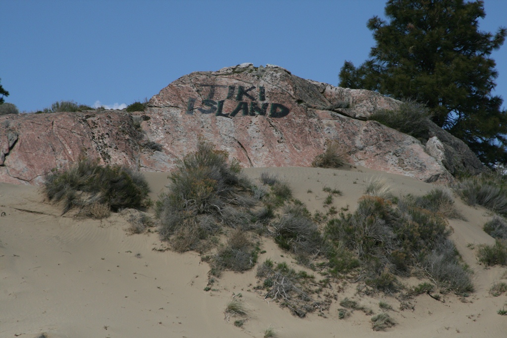
Tiki Island? We're a little far north folks....
Banks lake makes for a great time for everyone. Hiking, paddling and the stunning geology can keep the curious intrigued for hours.
///////////////////////////////////////////////////////////////////////
Weekend 2: Motorcycle Trip (April 22-23)
/////////////////////////////////////////////////////////////////////////
Having been denied a bike ride over to Banks Lake the weekend prior due to snow and rain, I took the GS/A 1200 (Affectionately named "Gretchen") out for a more personal trip. Also to check on a used BMW Dakar G650GS in Ellensburg for Lori.
The weather was spectacular, the night was cold and it had a bite to it that kept me from sleeping well. The following morning was sunny as I took off to hike the looming giant above me known as Steamboat Rock.

View from the top of Steamboat Rock.

Dramatic cliffs and towering basalt columns.

I could have stayed here all day and been quite happy. It was warm and quiet, save for the occasional hawk screeching over head.

Looking out at the ice scoured rock islands that we paddled the week before.

The islands and rocky cliffs shown here were nice for viewing birds of prey and kayaking the week before.

These shots show the primitive boat-in camp grounds.

The sandy beaches and the warm spring weather were very inviting.

I spent 3 hours hiking on the top of Steamboat rock peering over rocky ledges and examining the basalt cliff columns in wonder.

This is the top of the mesa. Sheer cliffs drop off straight to the water below. Look closely, one can see the hiking trail which circumnavigates the top of Steamboat Rock.

Another shot looking back towards the campground.

Although, Steamboat rock is a made up of basalt and lava (spewed more than 500 feet thick), one can see glacial erratics formed elsewhere on the top. These granite rocks came from as far away as Montana as they were encased in glacial ice.

Across the mesa, one can see a cave carved into the basalt from the incredible floods. Above that, is prairie land up until base of the cascades (snow covered Mt's in the distance).

There are a couple of herds of deer living on top of Steam Boat rock. Since this is a park and are not hunted they exhibit little fear of people. I happened to come across one of the herds quietly lounging in the shade.
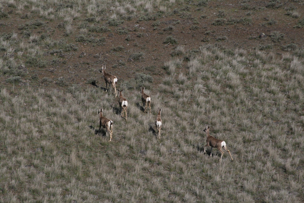

See the herd scamper away from me on the mesa?

As I made my way across the center of the mesa, I discovered that the deer still must encounter a natural enemy from time to time. I suspect this deer met its demise from a cougar. Possibly a rattlesnake bite, not sure if that would be enough to kill a deer. However, rattlesnakes are prevalent in the area and a prudent hiker will be on the lookout for them.

My motorbike camp just below Steamboat Rock. The day was warm, but the temperatures plummeted to near freezing at night. I was a bit chilly. I had lots of visitors coming by to chat with me, mainly they were interested in Gretchen with her big twin cylinder engine and sexy good looks.

Leaving Banks Lake, I stopped to take a long look back.

Steamboat Rock is the farthest mesa in the back. Awesome motorcycle country. Warm inviting roads just begging for two wheels. Shortly before I took off from here, a "herd" of Harley riders (~25) of them passed by. I followed them to Coulee City where we parted ways.

I continued to Ephrata and on to I-90 and crossed the Columbia river at Vantage.

I made a quick stop at Ginkgo Petrified forest. Yep, before the Cascades formed, this was a lush forest. Lava flows buried the trees and the massive glacial flooding unearthed them.

I ran into this beast. Luckily I was able to make a quick getaway on my bike.

Seriously, I hopped off my bike and took these pictures before the Dinosaur made a snack of Gretchen.

OK, so it was a static display and a tourist trap. Look at all those ancient petrified trees laying about.

I made a stop a the newly opened Puget Energy visitor center.


They told me that I couldn't park my bike here.

The visitor center is located at a drafty 3500 feet of elevation (one of the windiest spots in WA State). Off in the distance, the snow covered foothills of the Cascades could be seen.

This is one of the wind turbine blades. It is a single airfoil. It is huge. I read that the foundation for each wind turbine extends 30 feet into the earthen basalt and is anchored by 250 yards of concrete.


These wind turbines look like something out of the future. It was an eerie feeling to stand next to these giants. They look very ominous and reminded me of the obelisks in Kubrick's Space Odyssey.


The entrance to the visitor center was 3.5 miles from the road and gained quit a bit of elevation. There were signs stating the road was primitive and motorcycles should use caution. I had no problem as the road was nicely paved (chipped sealed) all the way to the top. My only complaint.. the posted 20 mph speed limit kept me from having too much fun.


A parting shot of me before I rode alongside the Yakima river into the mountains where I eventually got on the freeway and headed over the snow covered pass to home in Sammamish, WA.
Until next time....


_0002.JPG)
_0004.JPG)
_0005.JPG)
_0008.JPG)
_0010.JPG)
_0013.JPG)
_0015.JPG)
_0017.JPG)
_0019.JPG)
_0022.JPG)
_0023.JPG)
_0026.JPG)
_0027.JPG)
_0029.JPG)
_0031.JPG)
_0032.JPG)
_0008.JPG)
_0006.JPG)
_0011.JPG)
_0012.JPG)
_0013.JPG)
_0015.JPG)
_0017.JPG)
_0019.JPG)
_0021.JPG)
_0022.JPG)
_0024.JPG)
_0025.JPG)
_0026.JPG)
_0027.JPG)