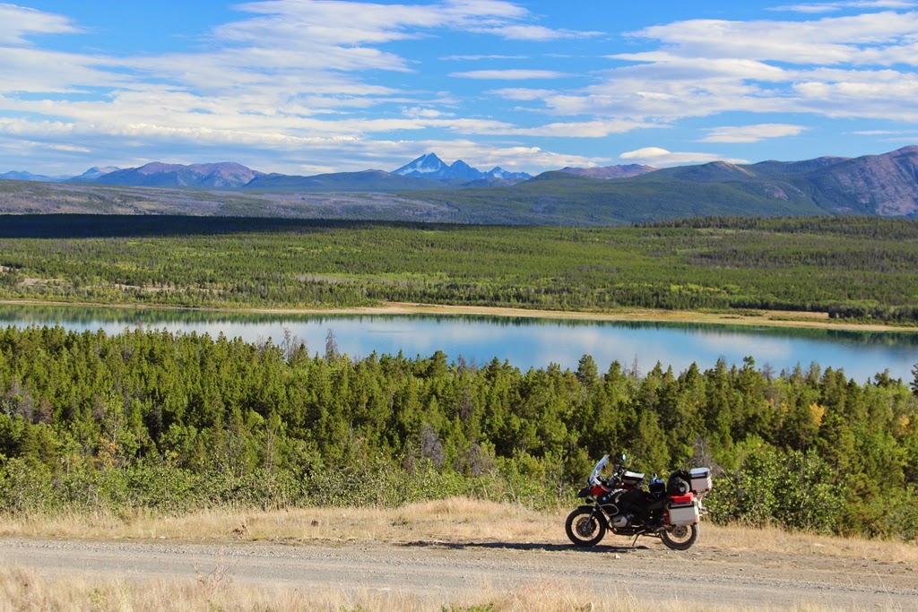
RubiKon Adventures

Tales and travels of "GrizzLee", "Looksha Lori" & "Yukon Johann"


Tuesday, November 12, 2013

Day 5 - Destination Nuxalk Nation: A Solo Adventure Ride to Bella Coola

Day 5: Undiscovered Country

The undiscovered country from whose bourn no traveler returns. - William Shakespeare.

Video - Day 5: Undiscovered Country

As I left Bella Coola the next morning, I wanted to take a side trip up to a lake and get a view of the sound via the Clayton Falls Creek road. Unfortunately, there was residual clouds and fog. In talking to the locals, I wouldn’t see much, if anything. I decided to leave town and head up Heckman pass and explore the route to Chilko Lake if I could arrive there at a reasonable time. I wanted to do some exploring on some other roads if the weather allowed for it.

End of the road in Bella Coola


The ride in the valley was beautiful and is paved for approximately 50 miles before giving way to gravel at the “Hill” to go back up to the pass on the Chilcotin Plateau. The weather began improving considerably the farther inland I traveled. I made a few stops, including the “big” rock at the Kettle Pond Trail. However, there was one road I wanted to ride if at all possible.  Just before ascending the road up to the pass at the head of the Bella Coola valley, there is a road (the old Tote Road) to get to the trailhead that I’ve always wanted to hike (Hunlen Falls). I had no plans to hike to Hunlen Falls, which I understand takes about 6 hours or so, but rather to explore it for future trips. The road is rough and not maintained. As I entered the road, two things caught my attention. 1) There was a notice stating that the road is not maintained and that 4x4 vehicles are recommended 2) Visitors are advised to not hike during the late afternoon, evening hours due to heavy grizzly bear activity along the river during the salmon spawning season. After my experience on the West Harrison Lake road, I did not have any desire to attempt a 4x4 trail. However, I decided to ride a ways in to see what the road was like and find an appropriate turn around point. In fact, I was hoping that I may catch another glimpse of some bears. I rode in about 3 miles or so and decided to turn around. The road was “OK”, but I figured that I was wasting time, especially if I wanted to make it to Chilko Lake that evening.
Double track road through an old burn area
 

Eventually I pulled back out on to hwy 20 and headed up the hill to Heckman pass. At this point, the sun was partially exposed and the dark clouds seem to be dispersing. Once at the pass, I saw the turn off for the hiking/pack trail out to the Rainbow Range in Tweedsmuir park. In fact, at some point, I believe I entered the park, most likely at the bottom of the hill. I had passed this turn off for the Rainbow ridge the last couple of trips and this time I decided to see what the trailhead looked like and maybe read about the trail and such. Again, taking note for future excursions back there.  Too my surprise, there was an old 2 track road that went farther back. In fact, this road appeared on my GPS and looked like it looped back to hwy 20. I said to myself, what the heck? I’m riding alone and no one is out here. Why not go explore more remote back country. The road, was wonderful as it made it ways through an old burn area and crossed many creeks and even a horse corral. It eventually looped back to the hwy as shown, but there was a problem. The road was hiden from hwy 20 and there was abig drainage ditch that I had to cross. I did a little exploring on foot and found a way to cross where it looked as if other off road vehicles and snowmobiles have gone. No problem. I stopped for a late lunch in Nimpo Lake. I had a homemade personal pizza and poured over my maps some more. I wanted to get over to  Gwedat’sih campground  at the north end of the lake. I found out, in talking to the locals, that it was closed due to lots of grizzly bear activity. No problem, I see that there is a road over to another campground (NU CHUGH BENIZ) further south along Chilko Lake.
Time travel on the Chilcotin Plateau

I arrived in Tatla Lake after detouring over to One-Eyed lake and some other road near Kleena Kleene to get some gas. I was told that it was a rough road over to the other campground and that it would be long after dark when I arrived. However, there was lots of places to camp back there. I decided to go for it anyway and took off for the Chilko Lake.
No camping... BEARS and more BEARS!!!
I took a side detour over to Tatlayoko lake. It was gorgeous and if I had any smarts, I would have camped there for the night. Instead, I turned around and went towards Chilko Lake. Sure enough, soon after the turn off, I see a provincial park notice stating that the campgrounds are closed due to bear activity. I wasn’t too upset, because a few miles later, I came upon expansive views of Choelquoit Lake. I pulled off the road and climbed up the hill above the road. There were large rocks scattered about, in among the sagebrush. I sat on the ground, using one of the large rocks as a back rest for about an hour. I have never seen land like this. The mountains beyond the lake were green and lush. The landscape changed dramatically within 5 of miles. I was looking as glacier covered peaks from the comfort of a sage covered hillside.


Choelquoit Lake an the surrounding country... WOW!!


Click on this picture for a beautiful panorama
Eventually, I decided that I should be moving on. Any hopes of arriving at the campground farther south along Chilko Lake that evening were fading fast. I kept riding towards Chilko lake and came upon a handful of natives fishing for salmon. They convinced me to turn around. They repeated what I heard earlier… “The road is rough and I would arrive long after dark”. I check my maps and attempted to ride along the Chilko river back to hwy 20, eventually camping at Bull Canyon. My plan was short lived as the road I was to take, was closed due to a slide. Darn it!!! I was shunned again. I was pretty tired by this time and started heading back to Tatla lake.  I came across a turnoff to Cochin Lake. I see a beautiful campsite next to the lake. For the 2nd camp on the trip. I share a campground with others. I had a very relaxing dinner with the songs of Loons and a visit by a lone otter. It was the coldest night of the trip. I curled up in in my sleeping bag with my tent flap open with fantastic lake views. I fade off to sleep, my head filled with cobwebs and pleasant thoughts about the past couple of days.
Another fantastic day comes to a close
 
 
Stay tuned for Day 6

Thursday, November 7, 2013

Day 4 - Destination Nuxalk Nation: A Solo Adventure Ride to Bella Coola

Day 4: Bella Coola and Bears


"...for many of us the world would be a poorer place without bears. We keep bears because they are a part of nature and because of what they do for the human mind, body, and soul." ~Steve Herrer


Video - Day 4 Bella Coola and Bears

I awoke the next morning to sunshine and rising mist fog as the water from the night before was evaporating. The land had a nice smell, like after taking a bath with pine scent. My morning breakfast was complimented by the song of a couple of loons echoing off the lake. Pinch me, I thought, I must be dreaming. How could this be. I felt like Alice in Wonderland. I was in no hurry and was slow in packing. I sat by the lake for a spell looking toward the glaciated coastal mountains. It looked as if another storm was forming in the distance… the direction I was to be heading today.  

Morning camp at Fletcher Lake

My original plan for the day was to pop out onto Hwy 20 at Hanceville (Lee’s Corner) and fill up on gas. From there I was going to head out to the Nemiah Valley to Chilko Lake all on dirt/gravel roads. However… When I arrived at Lee’s Corner, the owners and another motorcycle rider told me that the weather forecast was for rain today, especially as one got closer to the coastal mountains. Furthermore, they advised not to ride the roads when they are wet. Some of the roads are very slippery with mud and a 4x4 is highly recommended when wet. On a bike they said it would be tough. I understood completely. They treat the roads with Calcium chloride and if my travels north served any lessons to me, it was that wet and calcium chloride treated roads equal bad riding conditions for motorbikes. I was a bit disappointed, as I really wanted to go to the Nemiah Valley and Chilko Lake. As it was, I was now concerned about “The Hill” going down to Bella Coola.

 
Lee's Corner (Hanceville) - Gas, Grocery's and a weather report

So I grabbed some lunch at Lee’s corner and head out on highway 20 toward Bella Coola. I rode through Alexis Creek and Bull Canyon. All the time thinking that this would be an incredible place to live and have a ranch. I’ve ridden this stretch before and took a couple of side trips to some lakes along the way. Late afternoon arrived and the sky was overcast, but still no rain.
 
All alone at a lake - No reservations, no permits ... Nobody!!!

Old cabin along hwy 20 - Someone once lived here
I entered Tweedsmuir park and began my descent down the hill to Bella Coola. I assessed the valley and the weather from Heckman Pass, which is 5000 feet about the valley floor. It appeared that there was some showers in the valley, but no moisture on the hill going down. This was a good sign. It was now Tuesday and there was not another car or truck on the road. 
Heckman Pass Viewpoint (5000' in elevation)

Out of the blue I came upon a Grizzly sow and her cub walking casually up the road from the valley. As I understood it, the salmon were running and I couldn’t quite understand why these bears were heading up instead of down. In any event, I stopped and got some video footage and pictures of the mom and her cub. Mom would occasionally go out to the middle of the road and stare me down. Eventually she would give up and amble off the side of the road. I would then turn my bike around and go 100 yards or so up the hill and wait for her to re-appear. Again the ritual of walking out in the road and trying to make a stance would commence. Eventually, mom would give up and return to the edge of the road and disappear. This went on for 3 or 4 cycles until I decided to let them be. It was a wonderful experience to see such creatures as these. It was clear that mom didn’t like hiking the bush and rather use the road. Who can blame her? At no time did I feel threatened. The mother bear was a good mom, and I could tell that she was very protective of her young, setting a fine example for him (her?) to follow.

 
Mother Grizzly in a standoff - Who really owns the road?
What a pair these two made
Moving on.. She is a good mom
Jr (The cub) was ever so curious about me

I made may way down to the valley and it began to sprinkle a bit. Eventually, the light precipitation gave way to rain as I entered Bella Coola. As planned, I did check into the Bella Coola Inn for the evening and had a fine dinner there. I reset and planned my route for the return trip. I did happen to run into a fellow PacNW GS rider and his wife in Bella Coola the next morning. I shared with them my bear experience and they were jealous. 
 
Bella Coola Harbor
The end of the line... as far as one can drive the mainland of western Canada

My approximate Route form my home to Bella Coola (click to enlage) 


Google Route provided in this link.
Note: Use at your own risk as the route is approximate and not suitable for all riders and vehicles.

Stay tuned for Day 5 

Saturday, November 2, 2013

Day 3 - Destination Nuxalk Nation: A Solo Adventure Ride to Bella Coola

Day 3: Big Bar Ferry and Beyond


As day 2 of my ride came to a close, the sky was getting angry and it looked like a storm was brewing. After being told adamantly by the locals that it was going to storm overnight and into the next morning, I decided to get motel in Lillooet. Now Lillooet, isn’t much of a town. Main street consists of a bar, a couple of hotels and a gas station. It is quite the location as is sits in one of the driest and hottest locations in all of BC. The clouds pass over the high mountains, dumping very little precipitation. The area is also unique from a native history perspective. It is one of the oldest continuously inhabited places on the North American Continent. The confluence of the Fraser river and many major streams combined with the warm long growing season made it an ideal meeting place and residence for the indigenous people. In fact, in my visits there, I’ve encountered more 1st nations people than outsiders. In the summer months when I have passed through, it has always been hot.
My day started in a hotel in Lillooet to a nice partly overcast day. No rain. I wish I had gone with my original instincts and the weather report I had read prior to leaving my home in Washington state and camped out. Oh well, a good shower and a good meal were needed. After a good breakfast, I headed up the West Pavilion Road  hoping to cross the Fraser River at the Big Bar Ferry and then across the heart of the Chilcotin Plateau. As was to be normal for the entire trip, I had no planned destination and would camp wherever I saw fit.
Native Fish Camp
 

West Pavillion Road... Heavenly Ride


Fraser River canyon is beautiful

Moran Canyon... The most dramatic section of the Fraser River

The first sight I had was seeing a fishing camp along the Fraser. A narrow slot in the rapids of the Fraser are choice for native dip netting. The salmon were running and I was told that the bears were out in force. I would see 6 bears this day. The road quickly climbed up in elevation and soon I was high above the river valley. The photos look as if I was in a helicopter floating over the canyon. It was quite a sight. In fact the entire road to Big Bar Ferry was a sight to behold. It provided dramatic vistas at nearly every corner. During the course of my travel here, the road dipped in and out of the forest where I would intermittently see open range cattle, bears and Ptarmigan. Once I arrived at the road to drop down to the Big Bar Ferry, there was  dramatic shift in grade.
Remote desert in British Columbia?!?!

Unbelievable roads

Descending to the Big Bar Ferry

Awesome

I feel like a modern day explorer

Surreal beauty and loneliness

The land tells a geological story

Basalt lava is exposed

Bassalt and sandstone

I believe one sign stated a 14% grade, but I swear it was much worse in many sports, perhaps up to 20% or more. As I descended into the river canyon, the trees gave way to sage brush and the road… ah yes, the road turned into a horrible mess. At times I was nearly axel deep in sand. Not just ordinary sand. This stuff  was like fine talcum powder. I nearly dumped my big GS a couple of times. I must have been a sight to see as I had my legs out like training wheels to keep the bike upright. Because the grade was steep, I could not alleviate the load off the front wheels. I would encounter vehicle tracks and they would pull me in every direction and I had to pay strict attention to keep upright. Thankfully this lasted only a couple of miles until I came to the loading ramp of the ferry. Man, I was dripping with sweat and the temperature must have gone up another 10 degrees. It is really different world in the deep canyon. Much more arid sage brush down there.

Waiting for the Ferry
Cool Ferry ride
The Big Bar Ferry is interesting in that is a “reaction” ferry, powered by water current. It is connected to a cable spanning the river and propelled by angling rudders to drive the ferry across. Once across, the road leads up to Big Bar Ranch and Jesmond. My destination was to go beyond there and out past Gang Ranch and head over to the Nemiah Valley.
Looking back at the escarpment I came down
 
After much anticipation of more sandy roads on the east side of the Fraser river, I was pleasantly surprised by the lack of sand and the firmness of the road there. It also helped that the road wasn’t quite as steep. I was having fun again and versus the terrifying death grip I had on my handle bars on the other west side.

My route takes me up into the plateau and out of the sage into trees
It was here where a bear came sneaking up behind me
As I proceeded up the poison lake road, I came across more open range cattle and more bears. In one case, a bear had found a juice bottle and proceeded to run down the road in front of me, refusing the let the bottle go in his mouth. I guess that he finally had enough and needed more oxygen and released the bottle where he took an immediate left in front of me into the woods. About 200 yards later I stopped for a snack. While there, I heard some rustling in the bush behind me. I happen to turn around and see a bear (same bear?) staring intently at me. He/she stood up to get a better view and I reached for my camera. Unfortunately, the bear must have been startled by making eye contact with me and turned tail and ran, crashing through the brush. I could hear the bear crashing for 100 yards or more pounding the bush as it was to make it’s escape.
Approaching Churn Creek Provincial Park
 
Riding parallel to the Fraser River Canyon
 
Stunning views
 
The land gives hints about massive flooding
 
Crossing the Fraser River (looking north)
 
Looking south as I cross the Fraser
 

Water carve sandstone walls deep in the canyon


I almost camped here beside Churn Creek

From there I rode over toward Canoe Creek and encountered yet another bear. This time, I could see the bear in the distance ambling down the road long before it noticed me. I stopped to get my camera and proceeded slowly forward. The bear heard my engine and crossed the road to my right and paused briefly, looking at me. It then disappeared into the brush and all I could see was its haunches as it casually walked away from me. Soon after I was running parallel to the Fraser River near the Churn Creek Protected area. The area is a mix of dry arid canyon land that dips off the edge of the Chilcotin Plateau grasslands. It is a fantastically beautiful country with grand vistas, colored rock mixed with golden grasslands and green trees. I crossed a metal grate suspension bridge and then made my way up to Gang Ranch.  It was now late afternoon/early evening. I stopped in for a soda at the general store which also serves as a post office. I checked to see if there as camping and was told no. So off I went hoping to make it out to Fletcher Lake before it got too late in the evening. By this time, the sky was beginning to thicken with dark sinister clouds. Another storm was brewing.
Arrival at Gang Ranch
 
It is a beautiful ranch
 
Post office and General Store
 
Grasslands around the Gang Ranch
 
Arrival at Big Creek Junction
 
A pay phone out here? It works... I made a call home
 
View from my camp
 

Loons keep me company and other waterfowl sing while  I have dinner
I found my way over to Farewell Canyon Road and headed west. As I reached Big Creek I discovered a pay phone out in the middle of the sticks. Huh??? I stopped and called my son back in Sammamish, Wa. Surprisingly the phone worked. From there I rode past Rushes Lake and pulled into the Fletcher Lake Campground. This was great. I was at the tail end of the Labor Day holiday weekend and found that I had the camp ground all to myself. I needed no reservations and didn’t have to purchase a permit. Furthermore, I had fresh chopped firewood stacked underneath my picnic table. WOW, Pinch me, I was dreaming.  As the clouds formed the sun was setting and I enjoyed a fantasy sunset of orange, pink and golden yellows. As the last vestiges of light were fading, I felt a few rain drops. I had barely enough time to put my gear away in the tent and cover my bike before the sky opened up and I was greeted with thunder showers. I was pretty spent by this point and I faded off into the night with heavy rain drops pelting my tent with the occasional crack of thunder proceeded by a bright flash of lightening. As I closed my eyes, I wasn’t worried. No work, no schedule, no problems. This thunderstorm was the least of any problems I had back home.
One final look at the sun before it disappeared

My last sight of the lake before I turn in for the night.. Priceless!!