"The Shortest Distance Between Two Points is Boring" ~ Unknown
Thursday, after lunch, my work was complete and I left for home. Most folks were flying back home that day. Not me. I had flight plans of my own. My route was to take me up north on Hwy 95 toward Tonopah, Nevada. About 35 miles south of Tonopah, I took a lonely road north of Death Valley National Park (Hwy 266) through ghost towns and over to Big Pine, California. From there I would aim my bike north along Hwy 395 and ride along edge of the Sierra mountain range. I would travel through the beautiful town of Bishop and continue north up to Reno. I then cut over to Susanville in northern California and headed over hwy 139 to Klamath Falls where I saw abandoned homesteads, wild burros and long horn cattle in the road. My journey continued north up Hwy 97 to Redmond, Oregon, passing Crater Lake National Park, numerous volcanic cones , lava beds, etc... I met up with my little brother, who happened to be vacationing at Smith Rock State park. From there, I headed over to Biggs Oregon, crossing the Columbia River and over to Yakima. From there I made my way home through familiar roads along the Yakima river and up over Snoqualmie pass where the sun failed to shine on the last part of my trip. Ahhh, the Seattle grey.... it felt good to be home. The trip was an adventure and the devil is in the details. Read on for more.
Read the blog, see the video

The weather stated that there was a storm front coming over the Sierra's Thursday evening dumping more late season snow in the high country. I was glad it was cooling off. It had been hovering around 100 degrees all week in Las Vegas. I failed to connect the dots. The physics of cold air coming off the mountains and then mixing with hot desert air does very little in the way of making for a comfortable motorcycle ride. Quite the the opposite. The winds were hell. Quite possibly the worst conditions I've ever ridden in my life.

I feared the end of the 4 lane hwy as Hwy 95 turned into a 2 lane wind tunnel. I was hugging the front of my tank with both knees and huddled behind my windscreen and leaning into the wind like never before. Cruising at 70 mph, large vacuums of air combined with tornado-like gusts blew me all over the road. To make things worse, on-coming semi-trucks, clocking in at 80 mph created a horrid vortex effect. I would slow down, praying that the car behind me would do the same and let me have some space. The way north was slow and I made several stops, chatting with fellow bikers to get conditions. Many claimed it got better the farther north one went and that it was raining with thunder storms in Tonopah. The above picture shows the turnoff onto Hwy 266 about 35 miles south of Tonopah. It looked pretty stormy north. I was glad to be heading west, into the wind instead of fighting the side gusts.

The winds did subside quite a bit as I got closer to the eastern foothills of the Sierras. Along the way, I stopped at a couple of vacant mining towns from the late 1800's and took a small off road trip to see some Joshua trees up close and in person. I nearly got stuck as the dry desert, appeared to be hard packed was an illusion and my bike sank in the loose dirt. The above picture is precious. I love the clouds and the mesa in the distance.

The road climbed to over 6000 feet and the air began to get cold real fast. The desert gave way to bristle cone pines (some of the oldest trees in the world).

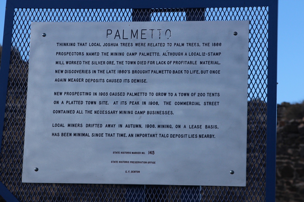
I stopped for a break at Palmetto, an old mining town.


The ruins were interesting and and I think I counted a total of 2 vehicles in the past 50 miles of travel. This was a lonely, desolate place.


As I came off the pass I spotted this dry lake bed, north of Death Valley. It looked like I was to drop a few thousand feet. The wind subsided and my spirits were high.

No such luck, as I dropped in altitude, the temperature went up and the winds began to hammer me like crazy. To top things off, the road was a bit different as well. Apparently, they decided not to waste time or money in keeping the road flat and smooth. It went up and down over "whoop-ti-doos". Not knowing what was on the other side combined with severe wind and dust blowing in my face made for some fun. Sand actually was forced into my helmet and many times, the vacuum effect made it feel as if my helmet was departing my head, stretching my neck with it.

Ahhh.. the edge of the Sierras, near Big Pine. The winds subsided.

It was getting late and I made my way to Bishop. The state patrol was pulling the big trucks over and advising campers not to proceed because there were "extreme" wind conditions up ahead over the passes. Not wanting to fight any more wind for the day and knowing darn well that if wind conditions were too dangerous for heavy trucks and campers, my featherweight bike was no match for it. I found a nice campground to stay the night. The only problem was that the big rigs began to trickle off the main highway as there was no room for them and onto the side roads they went. I had trucks pull up next to my camp around midnight where they would run their engines ALL NIGHT LONG... and the constant sound of bleeding air brakes drove me bananas. Out came the ear plugs along with my long underwear. It was a cold, sleepless night in my tent.

The next morning.... Cold and beautiful. No wind though. Yea!!!!


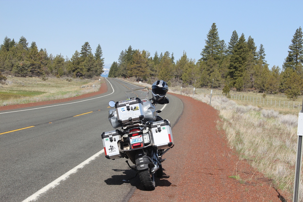
A little off-road travel was in order.

Up by Owens gorge, the scenery took a turn for the better. I had been back in this area more than 20 years ago. I don't recall it looking like this. Probably because it was hot, dry and California was in a drought.


A large granite massif could be seen in the distance.

Out came the camera. This was to be the drill for many, many miles on this trip.

Later that day, I came upon Mono Lake. Famous for the controversy as SoCal needed water and thought they should have the right to drain the lake and surrounding watersheds to appease the mass populace. Fortunately, wildlife studies, environmental effects and the great public outcry created a compromise and saved Mono Lake from total devastation.

I believe that Negit Island is a cone from resulting volcanic activity in the past. Many other cones can be seen nearby.

These little tufa towers (calcium-carbonate spires and knobs interacting with freshwater springs with the alkaline water) make for an eerie experience in this lonely land.

Clint Eastwood filmed the western cult classic "High Plains Drifter" at Mono Lake. The eerie tufa towers and lonely location only added to the effect of the ghostly story.


Click the picture above to see a panoramic view. A cone can be seen in the center

What the...??? On my way to Susanville, shortly after crossing into California, I came upon this lonely tree in the middle of nowhere covered in shoes. From this angle, it appears the tree was struck by lightning and split :-)

I arrived in Susanville around 6:00 that evening. I was planning on staying at Eagle Lake, about 30 miles north, but the campground doesn't open until mid May.


The next morning it was a bit nippy. As I toured the lonely countryside, I came upon the first of several abandoned homesteads. One particular stop, I noticed what appeared to be deer feeding in the distance. Upon alerting them, they looked up and and trotted off. Through the zoom lens of my camera, I noted that these were wild burros. A first for me. Many, many years ago, I saw wild horses up in this part of the country, but never a burro.

I forgot how the beautiful high desert mountain lakes and swamps come right up to the road. Lots and lots of bird life.


Later that day, I arrive at Smith Rock State Park.

I met up with my little brother. This picture is deceiving, as he is actually my height.

More rocks to explore.

Whoa!! I got lucky. The very brief alpenglow lasted only a few moments, but I happen to be at the right spot with my camera.


Smith Rock is famous for its towering rocks, beauty and is a world class rock climbing park. Many folks cut their teeth here before doing the "big walls".

The next morning I am off to see my brother and share a cup of coffee before I head home.


We took turns posing in front of Gretchen.

Matt was a bit bit envious of my girl.

The truth be known, he has a girl just like her. His girl is just a bit older though.


I made a pit stop at Peter Skene Ogden Park. Mr Ogden was a rough trapper and explorer who worked for the Hudson bay Company. He is thought to be the first white man to discover Mt Shasta and the surrounding Deschutes area and plateau. Look closely at the above photo and it appears that the Three Sisters Volcano's are sitting atop the bridge like lumps of mash potatoes on a saucer.

Arriving at Biggs, MaryHill and the Columbia River (see Mt Hood in the distance?).

On the MaryHill side of the river is a replica of Stonehenge. Curiously dedicated to war veterans?!?!


Look closely, you can see a windmill in the center from the local wind farm.


This is the last photo I took on my trip as I headed up and out of view of the Columbia river. I did take some Go Pro video along the Yakima river. I rode through Goldendale and arrived in Toppenish. This was some country I have never seen before. It was much more treed than I imagined...AND there was snow on the peaks as I rode through the pass. The weather was warm and pleasant. No wind. The perfect end to a memorable motorcycle adventure. My odometer, tells me I traveled over 2800 miles. My tires are complaining. It looks like I will need to replace them soon. I now have nearly 22,000 miles on the big girl. Every mile was ridden with a smile. I can hardly wait for my next big trip.
Until next time....