RubiKon Adventures

Tales and travels of "GrizzLee", "Looksha Lori" & "Yukon Johann"


Wednesday, July 27, 2011

RubiKon Adventure Quest 2011: The Drive Home on the Cassiar Highway

"To look backward for a while is to refresh the eye, to restore it, and to render it the more fit for its prime function of looking forward." ~Margaret Fairless Barber, The Roadmender

AWE THE CASSIAR... Perhaps the most remakable road in British Columbia.... Check that!  IT IS, the most remarkable road in all of B.C.
The flowers were in full bloom. We saw more bears than ever (0ver 20 in 2 days). RVer's at Jade CIty were complaining about the road.. We heard folks say "it's rough... narrow... dirty and has very little services... I'll never dirve this way again, worst road we've ever driven an RV on, etc...".  They forget to add that it's beautiful, remote and WILD.  Our kind of road! Folks, this is why we come up here. No strip malls, no services, no people. This is a true wildersness road without the gravel. It's too bad that soo few of these exist anymore. If you want malls and plastic trinkets made in China... STAY HOME!

Here is part of what we saw.....

Good Hope Lake. It's Good!


Flowers and more flowers.


Friendly natives who come right up to your window and greet you.
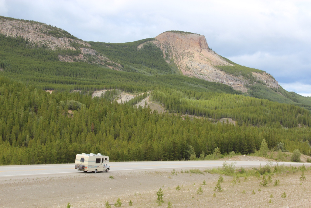

Meet the road crew.


These guys were busy building a dam across a culvert. They didn't seem to mind our presence and were quickly making the road a lake. I'm sure that some humans will disagree and re-claim the road soon after we are gone. 


These kids, or more commonly called "Kits", were cute little youngsters hangin out near their den. We saw no sign of mom or dad. They had the house all too themselves.


All of them disappeared as we approached. Except this guy, we was prepared to defend his home to the end.


This guy didn't appear to have a home. He wandered aimlessly along the side of the highway... looking for any meal he could find.


Hmmm... tourists. You guys look delicious.


Stay back boys.. or I'm going to have to eat you.


Who are you two? Are you new around here?


The views and the glaciers going to Hyder.


The flowers weren't bad either.


Hello. Surprised to see you here.


We toured some lava beds in New Aiyansh... or the traditional native village name "Gitlaxt'aamiks". Say that 10 times while holding your nose. 


Pictures don't do justice. The lava erupted 250 years ago wiping out most of the natives in the area. We are told that there is a volcanic cone nearby.  The lavea extends to the Pacific. There is a long canal that makes it way up to this part of the Cassiar coastal region.
BTW: It was a tough drive to get to this place. We took a side road off the Cassiar Highway to get here. It was advertised as a gravel road. It was one of the worst roads we've ever driven. The gravel was the size of baseballs and softballs. I guess there isn't a rock crusher in these parts on the 1st Nations land. I will never take a camper down this road again.


We did see many, many, many bears.


This cub was curiously turning over rocks, mimicking mom. Mom was close by and we didn't dare leave our camper. 
Driving through Burns Lake we see this "Flower Powered VW". It's the real deal.

Our 2nd to last morning in Canada (Jack O'Clubs Lake).

Our last wildlife sighting on the way home.

Our last day was spent at Bowron Lakes. We stayed at the Becker's Lodge campground. Lothar, the owner invited us as his guest. He even let us borrow a canoe. We paddled the length of Bowron Lake into the Bowron River up to an old heritage cabin, a 100 year old trapper's cabin. We saw about 7-8 moose in there, including a big bull with a huge rack. Non of them seemed to mind our presence. Unfortunately, the camera was left back at camp... DARN IT!!! All in all, we saw about 30 moose during our visit. We nearly got trampled by one at the lodge as it blindly ran up from Bowron Lake to evade some paddlers.

Our vacation/trek into the far north was a memorable one. We can't wait to go back again someday.

Until next time... 


RubiKon Adventure Quest 2011: The Drive Home - Back Down The Alaska Highway

"Dost thou love life? Then do not squander time, for that is the stuff life is made of." ~Benjamin Franklin


We arrived in WhiteHorse and spent a very nice evening with our friends (Shawn and Andrea) who we met on the Chilkoot trail in 2007. It was a nice visit as Shawn is a good cook and made us a fantasitc dinner. The next day we had to drop Lori off at the airport so she could get back to work while Lee and Johann drove home. 

We did have time to tour the Beringia museum in Whitehorse.  It is a worthwhile stop and a must see for first time visitors to the north. It is an educational experience where folks can experience close-up the animals and learn about how the land was shaped during the ice-ages. They have mammoth skeletons and one can learn how early settlers survived in a frozen world 16,000 years ago and survive today as the natives of the north. Facinating stuff!!


Extinct Sloth Bear.. behind glass in the Beringia Museum

Wolves as preserved in the Beringia Museum.

The WhiteHorse Rapids of the Yukon river outside of Whitehorse.

Looking at the Yukon River upstream. The rapids are no more as there is a hydro-electric dam in Whitehorse that tamed the river.

Yukon Johann taking a ride on a Caribou at Teslin.

GrizzLee shown here taming the wild beasts.


Look mom, no saddle.

The Alaska Highway is very scenic.

More scenery looking south into British Columbia.


Click to enlarge this panoramic picture.

We were at crossroads when we arrived at Watson Lake in the Yukon. We could continue south on the Alaska Highway or take the Cassiar Highway back down. We decided to take the Cassiar Highway. It was descision that we didn't regret.

Until Next Time....

RubiKon Adventure Quest 2011: Finishing the Dempster Highway

"Leave the World Behind for those of us who stay" ~ GrizzLee

Late update here. But it is worth noting the rest of our Dempster Highway Trip. We saw bears, moose and rainbows. Very, very scenic and beautiful.

We got the chance to see a mother and a cub. As we understand it, in the northern arctic, seeing bears with more than one cub is a rarity.

Awe the dirt. The road turned to mush and got really rough as we came through after a big rain storm. The big trucks cut big ruts in the road and made for some nasty driving conditions.

Our little Toy house has a little gas tank (only 17 Gals). So we had to carry extra fuel and fill up along the way. There is only one place to get gas between the start of the Dempster and the halfway point at Eagle Plains (~250 miles of raw arctic wilderness and nothing between).

The drive is like backpack trail in your truck. The mountains are scenic. Really no need to wander too far off the road to see the best stuff.

The Dempster highway has relentless beauty around every turn. 


This is Red Creek. The water is tinted red from the minerals in it.


The mountains have multi-colored layers. Click to enlarge this one and see for yourself.


The occasional rainbow.

Pilot's peak is in the distance. GrizzLee and Yukon Johann climbed this peak in 2007. It required crossing a river laden with ice. Great views at the top. No time to do so this time :-(

Two Moose Lake.

Looking back acorss the tundra.

Hey, there is a moose in Two Moose Lake.


Looking north... Inclement weather is always a threat on the Dempster highway.

Another moose in Two Moose Lake (now we understand how it got the name :-)
One last rainbow before we left.


We exited the Dempster and spent the night in Dawson City. The next day we washed the camper and headed to WhiteHorse. It was a rainy day. We ended up spending the night in the Coal Mine Campground (alongside the Yukon River) and feastign on some great hamburgers. Along the way, we saw a couple of Porcupines, numerous Ptarmigan and a Grizzly bear. Because of the rain and the fact that the animals crossed the road so suddenly, we didn't get any pictures. 

Untill Next Time...