Last year, I became fascinated with the idea to travel to Bella Coola during a rain-soaked motorcycle adventure up the Robson Valley and over to Bowron Lakes. I was able to go as far as Lee's corner in Hanceville, but that was enough to pique my interest in the area. As I formulated my trip for this year, I wanted to see some areas of British Columbia that I have never seen before and try out some of the off-road touring capabilities of my BMW R1200 GS Adventure bike. I've read that one can ride back country gravel roads from Pemberton (North of Whistler) to Williams lake. This was the kind of trip the bike was designed for. Is the BMW R1200GSA really the swiss-army knife of the motorcycle world? I wanted to find out.
Because I was riding solo in unfamiliar country, I decided to start my off-road journey at Clinton B.C and ride from Kelly Lake to the Churn Creek Protected area, crossing the Fraser river and on to Gang Ranch. Then following roads out to Farewell Canyon and eventually find my way to Hwy 20. From there, I would head west toward Bella Coola. I had no motel reservations, no itinerary (other than I wanted to goto Bella Coola and back home within 5 days) and planned to tent camp along the way. This was to be an adventure of discovery and wonder. Other than reading up on the route, to make sure it was passable with my big bike, I didn't want to know too much more than that and leave the rest to chance.
What I discovered, is that this is incredibly awesome country and I vow to return again next year. The bike performed wonderfully and I had no problems and didn't have any mishaps. Read on for pictures and some more commentary on my trip.
My route.
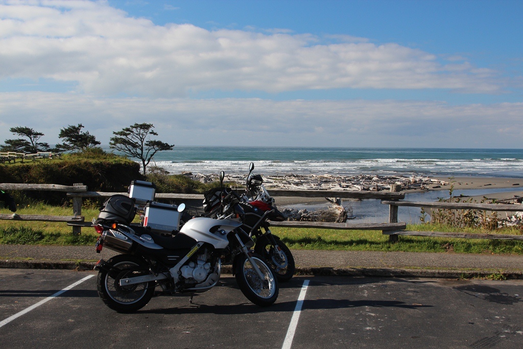
Leaving the stable.
End of the driveway waving to my family.
Saying goodbye to Lori and starting my solo adventure
The Thompson River as seen off of Hwy 97 in B.C.
More Thompson river looking from Skihist Park.
The river is incredibly beautiful.
My late afternnon arrival at the corner of Kelly Lake and the road north to Jesmond and beyond.
Old historic barn at Kelly Lake Ranch.
As I arrive at the campground, I nervously read this sign. I'm in a tent with no bear bins for my food.
My camp at Kelly Lake. Yep, that's Bear Spray on the table.. not a beer.
A pair of Loons sang me to sleep that night.
Kelly Lake from my camp.
The next morning I rode my bike up the remote gravel roads. Many ranches along the way.
The Marble Range was just beyond the ranches and made for a classic western setting.
Along the way I ran into "Boston Barbie". A wanted outlaw in these parts. (Click to enlarge).
It was weird to see this figure appear on the side of the road in such a remote area.
Yikes!!! She's hideous
I took a photo of myself standing next to Boston Barbie. She's big girl. I'm 6'3". She's not much smaller.
I constantly ran into cattle and horses on the road.
Many times they wouldn't move. Only when I got off my bike to take a picture, would they run away.
This was typical scenery of the roads I traveled.
Near the Canoe Creek "First Nations" Band village I came across this beautiful setting.
I saw 5 bears that day. While I taking a picture, this bear ran across the road in front of my bike. The bear startled me. As I took this photo, I heard a rustle in the brush behind me, it was another bear cub(?) coming toward me. I hopped on my bike and started it for a quick getaway. This scared the bear and it ran away opposite from its sibling. I concluded that these were young bears were more than likely just released from the care of their mother this year and were hanging out together.
Beyond the Canoe Creek village, the country opened up into a vast gorge where the Fraser river cut a huge canyon through here.
Down below I could see a bridge that I would cross.
On the other side of the canyon is the Churn Creek Protected area.
It was an amazing sight. I had no idea that central British Columbia held such treasures. The terrain and geography is absolutely stunning. Sandstone carved canyons, rivers cutting and flowing through ancient lava flows, endless graze land and spectacular views.
Down at the bottom of the canyon I nearly stepped on a
"Rubber" Boa. It scared the crap out of me. It was about 2 feet in length. This picture was taken shortly afterwards. I stood behind my bike, because I soiled my pants. OK, not really, but the snake did make me jump.
The entrance to the Historical
Gang Ranch. They used to drive cattle as far away as Utah to this area in the late 1800's up until 1950. It has a lot of history and for many years it was the largest ranch in North America. I think I look pretty good on my mount. Saddle up and let's ride...
Beyond Gang Ranch, my route took me through non-public maintained roads. At one point I was on a very primitive road with fallen trees and ponds in the road. I was a bit nervous as the way seemed to keep getting worse. My GPS showed many roads that no longer are used or have been decommissioned. Eventually, the primitive road gave way to a rough, newly graded logging road. From there I was able to head over to my next destination, Farewell Canyon.
This is Farewell Canyon and the Chilcotin River. The natives had pole nets out and were fishing for salmon at the bridge I crossed farther back.
I had to take this photo at
Lee's Corner for obvious reasons.
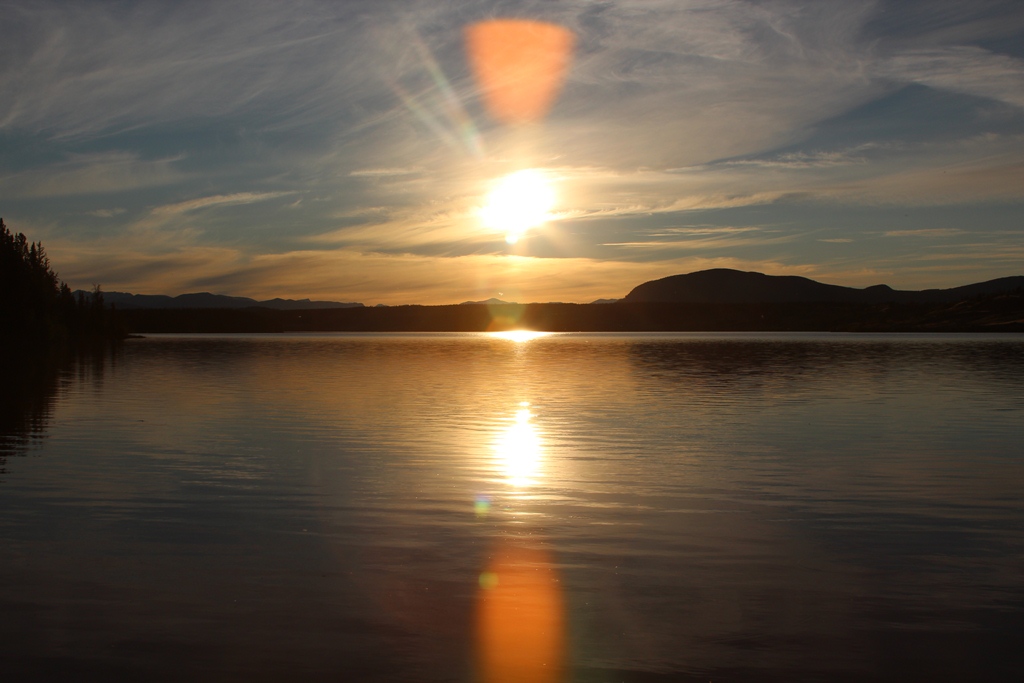
The second night I camped at a primitive campsite on the shores of Tatla Lake. Besides me, there was one other couple there. We had the lake all to ourselves on a holiday weekend. That's saying something for the remoteness of this area.
The sun was beautiful and warm. I took a swim and a bath in the lake. It was refreshing.
The sunset was marvelous.
Besides the other campers there, I was surrounded by cows on both sides of the lake. They were very noisy. As I went to bed tht night, I would've thought that a quiet night would follow. This was not the case. The cows got even noisier after sunset and in the stillness of the dark, their echoes could be heard throughout the night all around the lake. They seemed to be talking to each other in some form of alien cow language. I had to put my earplugs in to silence the madness.
The next morning I mounted my horse and began the ride towards Bella Coola. I could see the glaciated mountains looming in the distance.
After driving through Anaheim Lake and about 20 miles or so of gravel, I arrived at the top of The Hill known as the Freedom Road. The view looked ominous below. From the point where the road crosses Heckman Pass over the coast range the road descends 27 miles of steep, narrow road with sharp hairpin turns and two major switchbacks to the Bella Coola Valley. The descent includes grades of up to 18% . It is winding, in some places only wide enough for one vehicle, and in many places bordered on one side by cliffs and on the other side by a drop many hundreds of feet unprotected by guardrails. Tourists who have driven to Bella Coola from Williams Lake have been known to refuse to drive back and have had to be taken out by boat or float plane. To ride a motorcycle down this was going to take some marbles. Or so I thought...
It was steep, but it was also dry. Yes, there are no guard rails and a fall off the edge would prove to be fatal.
A fellow traveler and his chum took these photos of me. The drop off behind me went down about 1000 feet into the canyon below.
Closer up, it doesn't look too bad.
I made it. In reality, I found the Hill wasn't as bad as advertised. Perhaps a great deal more dangerous in icy, snowy and/or muddy condtions. I had none of these and I kept my speed in check. I also disabled the ABS brake system, so I could drag the rear wheel if needed.
The harbour at Bella Coola was relaxing and scenic. Even with the low hanging clouds, I could see beauty and imagine it to be even more specatcular on those rare cloudless days.
The drive through the valley to Bella Coola is very scenic.
Visual treats like this mountain and glaciers made it hard for me to keep my eyes on the road.
On the way in I saw 3 black bears along the road. The salmon were running and this fact disrupted my camping plans for the night. As most campgrounds were near the river, many were closed due to bear activity, while others only allowed "hard-sided" campers. Since I was tenting, I was out of luck and ended up staying at the Bella Cools Valley Inn. I enjoyed the company of fellow GS riders and in the morning I shared breakfast with a retired couple on holiday from Chilliwack.
On the way out I stopped by the Bear viewing platform, The platform was surrounded by an electric fence and over looked a gravel bar in the river. There were both Grizzly and black bears fishing. In my brief visit, I only caught an occasional glimpse of a grizzly fishing down stream from us. If you click to enlarge this photo, you can see him in the center. Not an impressive picture by any means... Just proof that I did see a grizzly... maybe.. its hard to see.
Another famous landmark in the area is this spilt rock. It appears to have rolled off the mountain and cracked open.
Back at the top of the Hill, I stopped within the boundaries of TweedsMuir Park to absorb the beauty. There was fire through here and the resulting chromatic colors made for good pictures and scenic views.
At the entrance to Tweedmuir Provincial Park.
Along Hwy 20 there are many artifacts from the past. I can only assume this cabin is the remnant of some past ranch activity. I noticed many of the natives seem to live in simple cabins. I saw one young native herding a string of horses through Tweedsmuir.
The road is not your normal road. Much of it isn't marked and it was littered with open range cattle and horses. Cattle guard crossings were commonplace.
All in all a great trip. I spent the last night at Williams Lake. The next day I road home. It was a bit chilly in the morning, but exhilarating. The ride was pretty lonely through the the Fraser river canyon and I was able to ride without the big trucks on the road. It helped that road construction held up traffic and I was able to get ahead of the pack before leaving Lytton heading south :-)
Next year, I have more ambitious plans. I ride from Pemberton north to Highway 20 all on back roads. I will proabably take an extra day to rest in Bella Coola and enjoy the bears.


