RubiKon Adventures

Tales and travels of "GrizzLee", "Looksha Lori" & "Yukon Johann"


Tuesday, January 17, 2017

The Movie: Tales and Trails of The Chilcotin, Bella Coola and Beyond

This is my story of riding a motorcycle to some of the most extraordinary country on the planet.

Several years ago, I accidentally stumbled on an incredible land known as the Chilcotin. It is magical place of beauty and history. The area contains not only huge rivers and mountains but also contains some of the largest ranches in North America and is home to one of the densest populations of Grizzly bears in Canada. This is the land of the Tsilhqot'in 1st Nations people; a land where one can see true cowboys; a land rich in spirit and adventure. Because of its sparse population, lack of paved roads (you will not find strip malls out here and even petro is sparse) a trip to the Chilcotin is always an adventure and more than that, it is a spiritual affair. 

This video provides my firsthand experience of riding a motorcycle through lowland rain forests, high mountain plateaus, glaciated peaks, wild rivers, crystal clear lakes, arid deserts, high passes and life at the edge of a continent. There is a lifetime of exploration and adventure out there.

I hope you enjoy this slice of adventure from my perspective   ~GrizzLee


Wednesday, January 11, 2017

Part 8 (The Finale): Tales and Trails of The Chilcotin, Bella Coola and Beyond

The final day…


The next morning in Clinton, I had to say goodbye to both, Paul and Brent. They had a ferry to catch, or rather I believe that Brent had a ferry to catch. So they left pretty early. I was in no particular hurry, so I after getting my bike ready, I ambled back to the Old Schools Bar and Grill for Breakfast.
Breakfast of champions

Good Food and very nice people
I had the best tasting breakfast on the entire trip here. I fueled up with coffee and surprisingly was able to make a phone call home from here to let the missus know my whereabouts and plans.
My plan was to head slightly north and take the Big Bar Road over to Big Bar Lake. This is a section of the Big Bar Road I have never been on before and always wanted to see the lake.
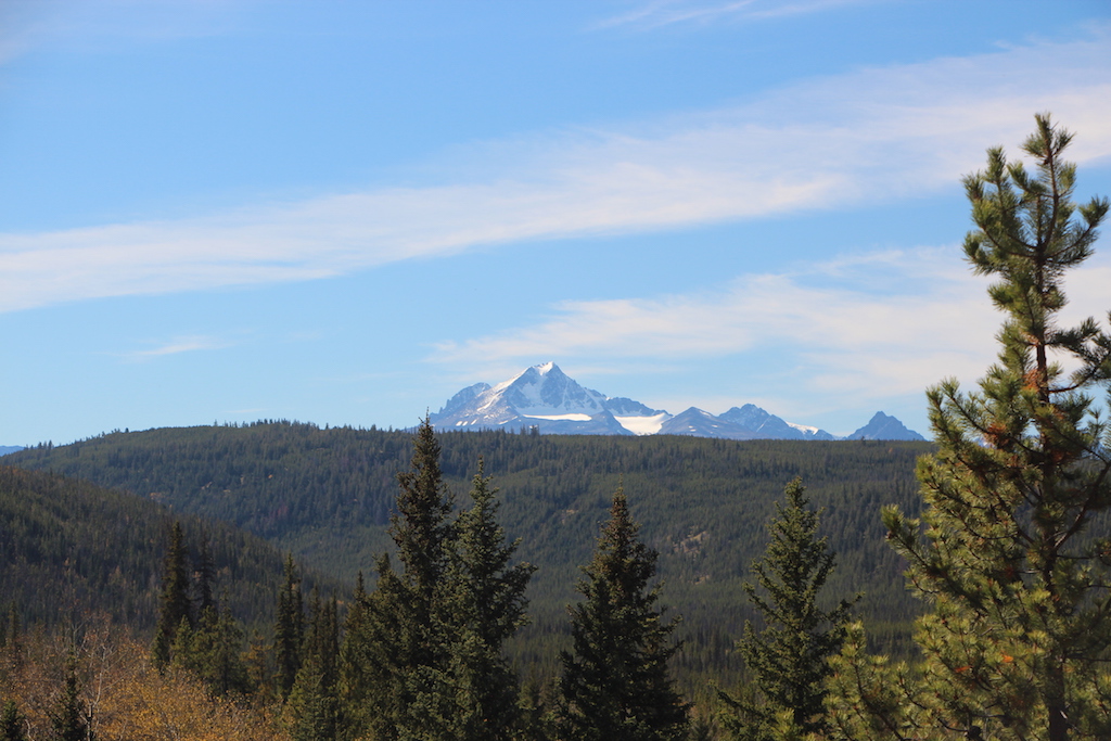
The ride was not much to see, except for the fact that I could now see the backside of the Marble Range. However, clouds were forming and the forecast was for rain. I was hoping that I could finish up the dirt portion of ride today before hitting the slab and heading south for the border.
I came upon Big Bar Lake and was surprised to find the area more developed than I had imagined. The lake was lined with cabins and the campground was really nice.
As I toured the campground I came across one campsite that was occupied by a bear trap. A nice hunk of meat was hanging inside the trap ready to spring on the unsuspecting bear.  In my travels near this area before I have come across numerous black bears, especially along poison lake road and out toward Canoe Creek. So this was no surprise to me. Apparently one of the buggers was getting too friendly with campers and action had to be taken out.


Bear trap to catch Yogi
Shortly after leaving the lake area, I came to the junction where the Poison Lake road joined the Big Bar Road.  My goal was to head south and take the Big Bar Ferry across the Fraser River and ride the Pavilion Road back to Lillooet. Which I did.
Along the way I passed the Big Bar ranch and numerous pedestrian cattle along the road. At some point I came across an outlaw wanted sign complete with a made up figure (life size) of a fictitious criminal. Now, I must admit, I was looking for this because every year it seems that one of the local ranchers (Big Bar Ranch?) has different criminal displayed with a new wanted sign stating the list of crimes they’ve committed. This year, it was the “Silver Fox” an older gentlemen who was a well known chicken thief. Free bucket of KFC for information leading up to his arrest 
Bike Selfie :-)


Wanted sign
GrizzLee and the Silver Fox
From there I turned at the Big Bar Ferry  junction that headed west down the canyon toward the Fraser River and the ferry crossing.
Survivor
The ride through here is really nice as one gradually drops down from the high plateau area that is fully forested to an aired desert-like gorge… actually more like a miniature grand canyon.
Several years ago I rode through this same area while the locals were finishing up battle with a wildfire. It was interesting to me to see how the land was recovering. In one clearing area, all the brush and trees were completely gone, however, a lone tree stood out; the top burned and the bottom burned, but the middle section seemed to be doing well. I called this tree “survivor” and it serves as a reminder of how mother nature can be fickle in this land.
View from above the river that I must ferry across

Looking up the other side of the Fraser River Canyon

From there I came out of a slot in the canyon that was perpendicular to the Fraser Canyon. The views were stunning as I looked at the road I must travel on the other side. It was quite steep and intimidating looking. Especially for a solo traveler on a large bike, fully loaded for adventure.

Making my way up the steep canyon road
I made my way down to the ferry crossing and waited about 20 minutes before the ferry operator came out and waved me on. We chatted a bit and he apologized for the wait. He assumed that other bikes would soon follow me as he said that it is rare for a single individual to pass through this area. No biggie I said. I could stay here all day and soak up the scenery, except, I knew there was rain on the way.

A bit about the ferries in this parts is in order. This ferry, and a couple of other like along the Fraser River, are “reaction ferries”. Reaction ferries are very efficient when implemented big rivers with fast moving current as they are attached to a cable and utilize the river current to propel them across using a simple concept of redirecting flow on lifting surface (rudders) in the water.


Once across, I began the laborious ascent up the canyon. I won’t lie to you. It was steep with sharp switchbacks and deep ruts in places from all the unusual rains this area has experienced over the summer. More than once I was fearing a tip over, or even worse, having the bike slide off the road after a tip. It would be impossible for me traveling alone to recover my beast from such an incident.


One last look before I clear the pass.
 Once I got out of the steep sections with the loose rocks and ruts, I could rest easy as I knew that rest of the way was relatively benign… at least based upon my previous travels through this area.


Before I completely “summited out” of the canyon, I stopped to reflect on my trip and enjoy the immense beauty this country has to offer. In all my travels north, there is nothing I have seen that compares to the vast, steep, undeveloped country that the Fraser River offers here. It is humbling and foreboding country.


Here’s looking at you kid
 Now that I was high above the canyon floor, I was able to take my time and ponder about all the land around me. One such area offered a deep look into a step narrow river creek drainage. I could see huge cuts in the canyon form glacial flooding and large outcroppings of rock. “Rugged” was the term that came to my mind, time and time again. Beautifully “rugged” country for sure.


Moran Canyon
In any event, as I got closer to Fountain Valley I had my first encounter with people. Two dualsport motos (both Husqvarna’s I believe) passed me. We actually stopped a bit to chat. They had started from Williams Lake early that morning, riding all dirt down to Lillooet. Their plan was to circle out towards Carpenter lake area and return the next day. They however, knew rain was coming and they were none to happy about it.


After our brief encounter, I circled around the mountains and came to the overlook of Fountain Valley. It was at this point that it began to sprinkle. Nearly perfect timing for me. I was nearly off the dirt and would be arriving in Lillooet shortly. As I got closer and closer to Lillooet the rain got more intense. At a pull out I came across a group of German riders that were outfitted with Urals. They, like me were kitted out for an expedition. They had lots of and lots of questions about the road and my trip, but unfortunately for them and me, I don’t speak German and their English was almost non-existent. The best we could do was stand underneath a raincoat and point at the map.
I wished them luck and arrived in Lillooet soon after. I gassed up at the Canadian Petro store there and grabbed a sandwich. The gas station there had a little covered sitting area outside so I was protected from the rain. I called home and checked in with the missus.
Rugged

Ruggedly Beautiful
It was around 4:00 in the afternoon and I knew that it would be tough to get home now with the rain. What I eventually did was ride out to the confluence of where the Fraser river and the Thompson river joined, at a town called Lytton, and rode south along the Fraser River canyon past Hells Gate and the numerous tunnels. I knew this road well. Normally I enjoy this ride, but with the rain and the big trucks spraying mist all over me … not so much.
I ended up spending the night in Hope and making an early start the next morning… in the rain…. Whereby I retraced my route back to Abbotsford via Harrison Mills and the back roads to the Sumas border crossing. I arrived home about noonish, soaked but with a BIG, BIG smile on my face. It was one heck of a ride that I will never forget.
I thank you folks for sticking with me and reading this report and “virtually” riding along with me in my video.
If you are ever in the Seattle area, either passing through on a bike adventure or even want to find out more about my travels north… drop me a note here or on google. All riders are welcome. I will have a beer and bunk waiting for you. As I always say… your only payment is a good travel story.


Take care and safe travels.
-GrizzLee

Sunday, January 8, 2017

Part 7: Tales and Trails of The Chilcotin, Bella Coola and Beyond

The great ride Continues.....

We arrived at Lee’s Corner (officially called Hanceville) and enjoyed a nice lunch. Lee’s Corner Store is somewhat of an oasis and a hub; a meeting place out in the Chilcoton Country. The store is not much… a small cafĂ©, fuel, some hardware, liquor, fishing licenses, a laundromat and a small selection of food items.
However, it is also a place of historical value as the surrounding area was originally named Lee's Corner after Norman Lee one of the early pioneers and legendary cattle ranchers in the Chilcotin Region.
Norman Lee met with bad fate and with little success in his quest to go to the Klondike Gold Fields in the Yukon. I recommend that folks read his book “Klondike Cattle Drive” where his massive undertaking to the Yukon and how the epic journey ended in disastrous consequences.
The terrain and geography around Hanceville is absolutely stunning with river valleys; sandstone carved canyons, rivers cutting and flowing through ancient lava flows, endless graze land and spectacular territorial views.
After lunch we made out way past Riske Creek and over to Farwell Canyon. Farwell canyon is not only stunningly gorgeous it is of historical significance as well. It is known to the local Tsilhqot'in First Nation as Nagwentled - 'place of landslides'. It is a place of important salmon fishing and the spectacular Farwell rapids
The Chilcotin River flows here,
joining the mighty Fraser river just a bit
farther south at Sheep Range Provincial Park.
From a geological standpoint, the glaciers that were once estimated to me nearly 2 miles thick in this region all melted, carving these fantastic canyons as ice dams formed backing up water resulting in lots and lots of glacial silt. As a result, the land is unsteady and one of the reason why heavy rains make driving and riding in this area a real chore and even out right dangerous.
Farwell Canyon
The glacial fed Chilcotin River flows through here


The road winds through the canyon and up the otherside
Sod covered log buildings dotting the countryside
We headed out towards Gang Ranch but first had to pass through the Gaspard Ranch lands.

Along the way we came across old sod covered cabins and a farm. Numerous cattle dotted the roadsides. We even had to negotiate with logging trucks and the dust… oh my gosh. The dust was horrific. I got dust particles in every nook and cranny of my luggage, my riding gear and my bike. We made it a point to ride separated and the 3 of us were at times strung out as far as 2 miles apart to wait for the dust to settle. 

Eventually we made our way to the well known grasslands and the edge of Gang Ranch. The evening sun was stunning on the golden lands. It made for an enjoyable riding experience. Eye candy galore with rolling hills, majestic cliffs and canyons and not a paved road around for miles and miles and miles.
Yep, that is the “Gang Ranch” sitting in the valley below.
After riding through Gang Ranch we dropped dramatically down into the Fraser River gorge and crossed the Fraser River via the Gang Ranch bridge.
Here in the Fraser river canyon, I personally the dramatic scenery to be stunning. It is a drastic and somewhat sudden change from the high plateau country we just crossed. The canyon walls reflecting the late afternoon sunlight is breathtaking to say the least.
Through this section I slowed down a bit, to really soak it all in. It was a time of reflection for me.

My horse
The dramatic cliffs of ancient silt/sandstone along the mighty Fraser
Accidental selfie
Brent, Paul and myself eventually climbed out of the Fraser River canyon and regrouped just outside of a place called “Canoe Creek”. The sun was now setting quickly and I was very pretty excited now as I was hoping to see a bear or two. It seems like there is a 10 mile stretch just south of Canoe Creek where I always see some black bears. In fact, one year, I nearly collided with one here as it was lying in the road (napping?) as I came around a blind corner.  This time was no different. We saw two black bears grazing in a meadow. I presume they were siblings that were kicked out by their mom recently.  I didn’t take any pictures, but I did shoot some more video.
Sunset along Meadow Lake Road
Soon I found myself on a road I have never traveled before. That road being Meadow Lake Road. Paul knew it well however and we were trying to making it to Clinton BC and grab a cheap motel for the night.
Another lake in a meadow along Meadow Lake Road
The evening sun gave way to dusk and soon we found ourselves riding under a moonlit sky among hundreds of cattle which lined the road and much of the rolling hills in the countryside.
At one point Brent lost some luggage and we were talking about having to turn back to retrieve it. However, Paul, who was bringing up the rear saw it and saved us some time.

Riding under the moonlit sky was a special treat for me personally as I have never ridden much at night, especially in country like this. It was very surreal and enjoyable. However, it did have its drawbacks, that being as it got darker, it got increasingly harder to see the cattle and it was a bit dangerous IMHO to ride under such conditions. The cattle seemed less inclined to move out of the way as our lights blinded them. One thing I thought was cool was how the crying (mooing) of the cows echoed through the dark landscape. It added to the ambiance of the ride.

Full moon
 The ride through Meadow Lake road over to hwy 97 took much longer than anticipated and we had a short jaunt over to Clinton BC in the dark. Paul told us about a cheap motel which we are all excited to stay and clean up. However, when we arrived, all the motels were booked full. There was massive highway construction going on and the road crews were using the motels as temporary homes.
We managed to  get the last room but it only had two queen size beds. You can imagine how that went with 3 dusty cowboys and all their gear. I felt like I was back in college on one of my youthful road trips. It was a lot of fun. We did manage to get a nice dinner, as the diner down the street (Old School’s Bar & Grill) was still open at this late hour. Even better, as they catered to bikers and the entire place was decorated with Harley and other biker accessories.

I don’t know about Brent or Paul, but I slept pretty good that night. Still being severely congested, I can only hope that my snoring didn’t keep them awake.  I am sure it did, and they were kind enough not to bring it up. Great guys to ride with and I am happy to call them my friends.

Stay Tuned for the finale to this magnificent ride...

Thursday, January 5, 2017

Part 6: Tales and Trails of The Chilcotin, Bella Coola and Beyond

Are you kidding me? Another perfect start.


The morning cup of coffee view

Calm waters and warm weather. I had to continually pinch myself. “Wake up! Wake up!” I kept saying.
An image that will be forever burned into my memory.


Could this be another "Best Day"


The Chilcotin Biker Gang
Paul, Brent and I had some breakfast and ended up doing some minor bike repairs to Brent’s bike. Apparently he dumped it and broke a turn signal. Not a show stopper by any means. As we packed we talked about the incredible country and the ride we had the day before.


Posing with our steeds (Paul-GrizzLee-Brent)
 The ride was one for the books as far as beauty, minor challenge and most importantly fun.
We packed our bikes and headed out to Konni Lake. We stopped at the general store and topped off our fuel tanks and chatted a bit with some of the locals.
Konni Lake Log Church
 Soon after filling up, we headed out for more riding. We were heading for Hanceville (Lee’s Corner). In doing so we got to ride parallel to Konni Lake, with high mountains lining both sides of the lake and lots and lots of horses. At the far end (east end) of Konni lake, there is a lone log church sitting out there just up from the lake shore. Now I am not what one would call a very religious man by any means, but today, I would have gone to church and sang godly praises and given thanks for all that I have seen and experienced over the last few days. If asked, I would even dare say, I was in heaven. If not, it was something close to my idea of what heaven would be like.


Getting a lesson in spirituality


Looking back at the coastal range
We continued making our way and quickly found ourselves crossing the Tesako River and the road to Tesako lakes. Taseko Lakes is on my bucket list. A place that I hope to maybe explore within the next few years.

Gateway to the Tsilhqot’in Nation Aboriginal Title lands
 We pulled further and further away from the coastal mountain ranges. Every now and then we would stop and look back as we got more and more engulfed by the high plateau.


We eventually came across a monument and signs marking the entrance.. or as in our case, the exit of the Tsilhqot’in Nation Aboriginal Title lands. We liked what we read as there was agreement between the Provincial gov’t and the 1st Nations spelled out on the signs stating the intent to preserve the lands in their natural states …. No logging, dams (in or out of the lands) that would effect salmon runs, etc.. The conservationist in me was very excited to see this and I believe that all 3 of celebrated these facts and are happy for the 1st Nations.

Black (Brown in color) bear in the road

At this point, the roads were extremely dusty. We began to separate ourselves just far enough to let the dust settle. Just before arriving at Hanceville I found myself in the lead coming up to a corner where there was a big bull standing in the road. The bull seemed a bit agitated and I soon found out that it was for good reason. As I turned the corner, there was a nice fat black bear (brown in color) ambling down the road like he (she?) owned the place. As we approached the bear, it ambled a bit in the road and soon deduced that we were not going to leave it alone. So it exited the road and looked at us for a bit and then began foraging for bugs and grass, etc.. At one point the bear started coming towards us on the road. It came towards us in a friendly manner… like it had been fed by humans. Being on a bike, I was in no shape ready to have a bear come next to me begging for food.


More coming soon....

Tuesday, January 3, 2017

Part 5: Tales and Trails of The Chilcotin, Bella Coola and Beyond

The next day of my adventure was going to prove to be just as amazing as all the days before.


My Route for this day
Sometime during the night I seemed to have shown symptoms of some kind of cold/flu bug. My throat was sore and swollen. I had a hard time breathing through the morning hours.
Besides that, I was have the time of my life.

During some point between me cooking my breakfast and packing my bike, a local rancher stopped by and chewed my ear off.  Len Harris was his name and he told me about the history of the lake and the park I spent the night in. Surprisingly to me, he stated that the grizzlies like to come down to the lake though the park area I had just spent the night. I thought it was a bit safer as I was out in the open... more so than being in the trees and the bush. In any event he gave me the complete history of the mill and the logging operation along the lake. The logging operation didn’t pay too much mind to the environment in those days and in fact, the environmental impact of the logging was the reason it was shut down. The park had many cool commemorative plaques and such. It wasn’t hard to imagine what life was like out here in its hey day. Len told me he had run into a couple of riders on black bikes near the Chilko River. He asked if I knew them or was riding with them. I said no, but I had a pretty good idea who one of the riders was.


After Len left, I was finally on my way. I must admit, it was hard to leave. The weather was quite nice and the lake was still smooth as glass. But, being the greedy adventurer I am, I wanted to see more.


Breaking Morning Camp


Bike packed and ready


One last look down the lake... Still smooth as glass


I left Tatlayoko Lake in good spirits.
As I got on the road heading towards an area called Henry’s Crossing I came upon Brent and Paul. Paul and I have met before, in Lillooet the year before. Our paths were bound to cross as we both love the Chilcotin and it turns out, BMW Adventure bikes. Both Paul and Brent were riding classic R100 GS Paris Dakar bikes. Perfect bike’s for this kind of country.


They were actually heading out towards Highway 20 because some folks had told them the road was rough going from Tsuniah Lake over to Chilko lake (Neamiah Valley). Apparently, they ran into Walt, Boris and Norm at Fletcher Lake. They told a tale of mud and woe and how they dumped their bikes on the rough slippery road. A story that I didn’t doubt for a minute.


You see, the week before it had been raining, raining and raining… just like it had all summer on the Chilcotin plateau. I knew those roads would be greasy. One of the big reasons why I planned to go to Bella Coola first and then swing through this area after it dried out a bit.


It didn’t take me much to convince Brent and Paul to join me. I was going to go to Chilko Lake and the Neamaih Valley regardless of what people stated the road was like.… at least I was going to try. One of my arguments was that with 3 of us, it would be easier to lift fallen bikes. I was really excited to have company on this leg of my adventure because of the extreme remoteness and the rough road… a road that really doesn’t show up on many maps.


Unfortunately for you reading this, I took very little pictures of this day. However, I did take a lot of video with my helmet mounted GoPro and my Digital SLR camera. Alot more appears in the video… be patient. I will post that very soon.

We passed by Choelquoit Lake and stopped at the Chilko River to filter some water. From there we headed out to Brittany Lakes and over toward Tsuniah Lake. Along the way, we were stopped by one of the 1st Nations folks in a truck. He immediately pulled out a clip board and was asking my name. He also wanted to know what I was doing out here. I was a bit nervous at first, but when I questioned him, he stated that they were just taking a survey to see what kind of visitors they have travelling through their new land claims settlement. He stated that we weren’t allowed to hunt or fish on their lands. This was fine with me as I had no fishing gear or guns with me. Just some bear spray. 


Brittany Lakes
The three of us made our way to Tsuniah lake and encountered our first gate. In the past. There are several gates that must be opened and closed. This all added to the raw adventure we were experiencing. As we left Tsuniah Lake we were greeted by sow and her cub. They quickly took off into the woods. This was unfortunate as there was no time for a picture and unfortunately my helmet camera was turned off.


We made our way to this place that is shown on the map as a lagoon. We crossed a bridge along the narrowest part of the lagoon. I stopped to shoo some video. From my perspective, it is an amazing area to see.  My previous excursion through here yielded a lagoon full of spawning salmon. No salmon this time around, but still spectacular nonetheless.

The ride was just really cool at this point. We were riding along Chilko Lake and getting peek-a-boo views every now and then.  The road, while not really technical, offered plenty of challenge for our big dualsport bikes. It was just enough to make it fun and kept it interesting. Nothing that would make us give up or break out in hives. Very enjoyable for sure.


Scenic pull out along Chilko Lake

Does it get any better than this?
About half way between Tsuniah Lake and the Chilko Lake there is a nice clearing area that provides really nice views of Chilko Lake. It would be an ideal camping spot except there was a sign posted that there was no camping allowed here.  The views were stupendous and it was a nice place to rest and relax a bit.


From there we rode out towards Nu Chugh Beniz Campground located at the west end of the Nemiah valley on the shores of Chilko Lake.


On the way to the Chilko Lake Rec Site
We took a wrong turn at some point and ended up at dead ends into local residences. I looked at my map and figured out where we were and proceeded to take the lead. At some point, I got separated form both Brent and Paul. I retraced my route and there was no sign of them.


I figured that at some point we’d either meet up again or they would camp somewhere else. I decided that I would proceed to the Nu Chugh Beniz Campground. I was there for nearly an hour when Brent and Paul finally arrived. Apparently they rode as far as the Konni Lake General Store and then turned around.


A lone prairie surrounded by mountains
Looking West


Those are the start of the coastal mountains
We set up camp and was able to purchase some beer from a fellow camper in the campground. The weather was fantastic and we really enjoyed the evening.


And that was the end of one of the best days of riding out on the Chilcotin Plateau ever.