Day 7 (July 5, 2013)
We wake up to another picture perfect day at Bell II
Lodge. We spent the night in out tent. The place was wonderful, however the
mosquitoes were a bit much as the tenting sites were in the back near muskeg
and brush… We’d preferred to have camped out in the open more towards the lodge
were the bugs were less pervasive.
We got began our ride that day with a hearty breakfast
with coffee and hot chocolate courtesy of the lodge.
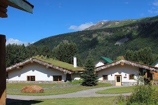 |
| Leaving Bell II Lodge... Cool place |
 |
| Soon after on the Cassiar Hwy |
Riding along the Cassiar hwy on this was marvelous, albeit on the warm side. We were on lonely roads for sure. We ride past Bob Quinn airfield and also discovered that we were following parts of the Yukon Telegraph line. A line that connected the Yukon Gold Fields to the outside world from 1899 to 1930.
 |
| We were following the Yukon Telegraph Line |
 |
| Rest Stop at Bob Quinn Airfield |
 |
| Mugshot |
 |
Damn this guy is handsome.
So is the guy riding the bike :-) |
 |
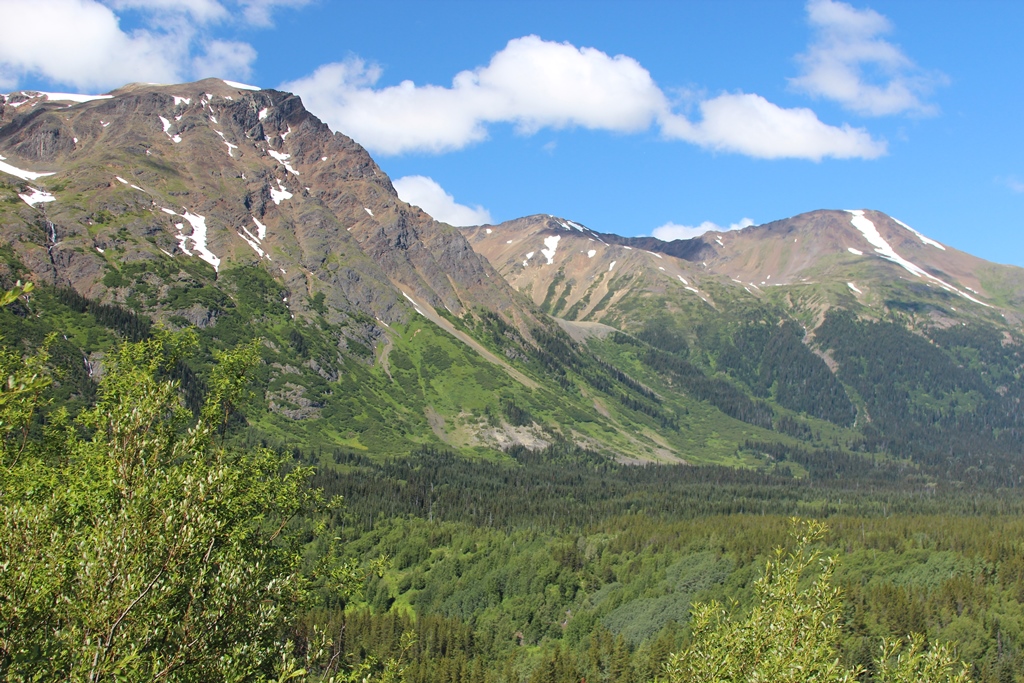
| Looking up into the mountains of the Edziza Plateau... |
 |
| Amazing Scenery |
We found ourselves traversing the Mt Edziza plateau in the valley below, all the way to Kinaskin Lake.
 |
| Another handsome fellow |
 |
| And his girl Gretchen |
 |
| Always keeping the boy in view |
The highlight of this section was Eddontenajon Lake. No wind and a sunny day, made for glass-like conditions on the lake. The reflections increased the WOW factor immensely
 |
| Holy smokes... one of those get off the bike and meditate for an hour scences |
 |
| WOW!!! |
 |
| WOW!!! x 1.0 E6 (Scientific notation for the uninformed there :-) |
 |
| Eddontenajon Lake near Iskut.... Man oh man |
 |
| GrizzLee highly recommends this view |
 |
| Time to go... sadly. |
From there we gassed up in Dease lake and had a burger. The gas station at Dease Lake is somewhat of a cross roads for motorcyclists heading north. The gas station serves as a grocery store and restaurant and carries some other necessities that are needed out in the bush, such as oil and a liquor store J
 |
| Off to Telegraph Creek. Gravel roads, canyons and steep cliffs.... |
 |
| Johann,, manhood is here buddy |
 |
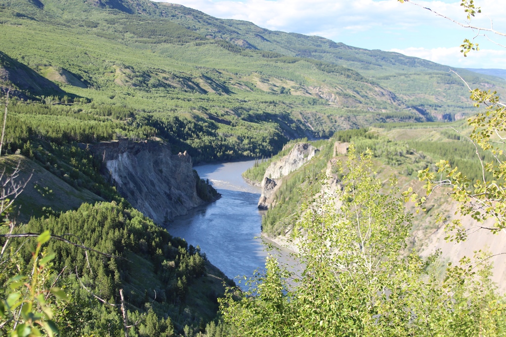
They call the Stikine Canyon the "Grand Canyon" of the north
Easy to see why |
We asked around about the road conditions out to Telegraph Creek and places to camp. One of the local native gals told us that the Chief was doing a charity bicycle ride out to Telegraph Creek and that they were having a Salmon bake to celebrate the arrival of the first salmon run. Furthermore, the road was in excellent condition. We were in.
It is 75 miles to Telegraph creek (one way), all gravel and dirt mixed with Calcium Chloride.
We didn’t care. It was a beautiful ride.
 |
| Looking west toward the coastal mtns |
 |
| Johann trying to fix the landscape |
First and foremost, the area known as the “Grand Canyon” of the Stikine has been compared to the Grand Canyon in Colorado. The Grand Canyon of the Stikine River in northern British Columbia is one of the greatest whitewater runs in the world.
Photographs
do not do the river canyon justice, nor do videos. The people who have been there understand and now we fully understand.
The Stikine has huge rapids, vertical walls, and lots of beauty. There aren’t many places that have the power to move people on such an emotional level such at this. Aside from important human development history in the north, the road to Telegraph Creek is on the northern edge of the Mt Edziza Plateau ,which is unique and littered with lava flows, offering striking rock formations against the coastal mountains in the background. The Stikine canyon features huge columns of basalt.
 |
| Trust us, these pictures can't do the extreme beauty justice |
 |
| Stikine River below |
 |
| Sacred Waters of the Tahltan Aboriginal people |
 |
| "Gorge"ous |
 |
The chief let us camp in Telegraph creek by the Stikine River.
The truck in the background was used to haul supplies up to the Dease River
in constructing the Alaskan Hwy. |
Telegraph Creek played an important role in this area and we got a first hand account from the Tahltan Nation, Chief Rick McLean and got personally invited to join them in a Salmon feast featuring Salmon, Bannock and fine desserts. The Chief gave us a run down of the history and role this area played in the Tahltan culture as well as how the Stikine River was instrumental in getting the Telegraph Line to Dawson and how it played a big in the Alaskan Hwy construction. Supplies were shipped up river from Wrangell to Telelgraph Creek (this is as far as they could go, the river is not navigable to “any” water craft, rafts and kayaks included) beyond the village. From there, goods were trucked over the very road we rode down to Dease Lake and down the Dease River to the Alaska Hwy camp up north (Watson Lake). The Chief gave us a personal invite to camp on his land by the Stikine River and a beer that evening.
It was an incredible day. We slept good that night and had an equally nice ride out back to the Cassiar the next day. We took lots of video that is sure to be posted here as well.
Thanks for riding with us.
Until Next Time....


No comments:
Post a Comment